Barmah facts for kids
Quick facts for kids BarmahVictoria |
|||||||||||||||
|---|---|---|---|---|---|---|---|---|---|---|---|---|---|---|---|

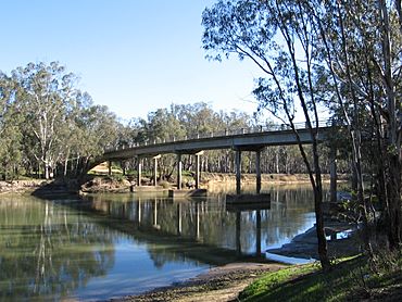
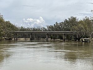
Murray River crossing at Barmah
|
|||||||||||||||
| Population | 282 (2016 census) | ||||||||||||||
| Postcode(s) | 3639 | ||||||||||||||
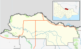
| Location |
|
||||||||||||||
| LGA(s) | Shire of Moira | ||||||||||||||
| State electorate(s) | Shepparton | ||||||||||||||
| Federal Division(s) | Nicholls | ||||||||||||||
|
|||||||||||||||
Barmah is a small town in Victoria, Australia. It is known for its special location and being very close to the world's largest forest of river red gum trees. This area is super important for nature and wildlife.
Contents
Unique Location of Barmah
Barmah has a very interesting location. It is actually north of the border with the state of New South Wales. Normally, New South Wales is north of Victoria. The border between these two states is the Murray River, which flows west.
However, near Barmah, the Murray River makes a big bend. It winds south and east for a short distance. Because of this bend, a small part of New South Wales ends up being south of Barmah, even though New South Wales is generally to the north.
Barmah National Park and Forests
Barmah is right next to the biggest river red gum forest in the world. This amazing forest is part of the Barmah National Park. The park is on the floodplain of the Murray River.
When the river floods, this area becomes a vital breeding ground for fish like the Murray cod. Flooding is made even bigger by a narrow part of the riverbed. This narrow section is called the Barmah choke.
Important Bird Area
The Barmah Forest is recognized internationally for its wetlands. It is listed under the Ramsar Convention, which protects important wetland areas. Along with other state forests in New South Wales, it is also an Important Bird Area. This means it's a crucial place for many bird species.
One special bird found here is the superb parrot. This parrot uses the forest as a breeding ground. The superb parrot is a vulnerable species, meaning it needs protection to survive.
History of Barmah
The Barmah area was first settled by Europeans in 1856. A man named Joseph Waldo Rice started a company there. His company, the Murray Fishing Company, supplied fish to the gold mining areas like Bendigo, Victoria.
In the early 1880s, Barmah became a busy and successful town. Its main industry was sawmilling. There were two big sawmills. One was owned by Robert Barbour on the New South Wales side of the river. The other was on the Victorian side, owned by James MacIntosh and E. Whitely.
Much of the timber, especially red gum, was sent to India. It was used for things like railway sleepers. However, the government later stopped the export of red gum. This caused the Barmah sawmills to close down for a while.
Later, trade improved as the railway network grew. A new sawmill opened, run by R. Evans. He used his steamboat, the Edwards, to transport sawn timber to Echuca.
A Post Office opened in Barmah on September 16, 1876. It was later renamed Barmah East in 1907 and closed in 1951. A new Post Office, called Barmah Township Post Office, opened on May 2, 1902.
Population of Barmah
According to the 2021 census, Barmah had a population of 229 people. Most people, about 87.8%, were born in Australia. Also, 90.8% of the people living in Barmah spoke only English at home.
Ancient Geography and the Cadell Fault
The unique landscape around Barmah is due to a huge geological event. This happened about 25,000 years ago. At that time, a part of the land suddenly lifted up. This uplift happened along something called the Cadell Fault.
This uplift forced the Murray River to change its path. The river had to find a new course for about 500 kilometers. It even ended up taking over parts of the Goulburn River's path. The uplifted land can still be seen today. It looks like a low, natural bank along the road leading into Barmah from the west.
 | Jackie Robinson |
 | Jack Johnson |
 | Althea Gibson |
 | Arthur Ashe |
 | Muhammad Ali |


