Bathurst County facts for kids
Quick facts for kids BathurstNew South Wales |
|||||||||||||||
|---|---|---|---|---|---|---|---|---|---|---|---|---|---|---|---|

Location in New South Wales
|
|||||||||||||||
|
|||||||||||||||
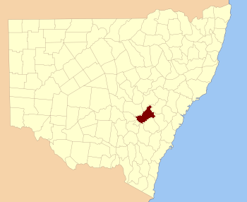
Bathurst County was an important historical area in New South Wales, Australia. It was one of the first 19 counties created when the colony was still quite new. Today, it is one of 141 special land divisions called cadastral divisions. These divisions help manage land ownership and records.
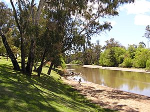
This county covers the area southwest of the city of Bathurst, stretching towards Cowra and Orange. The Lachlan River forms its southwestern edge, while the Belubula River and Fish River make up parts of its northern and northeastern borders. The town of Blayney is located right in the middle of Bathurst County.
Discovering Bathurst County
Bathurst County was named in honour of Henry Bathurst. He was a British Earl who lived from 1762 to 1834. Naming places after important people was a common practice in the early days of the colony.
Early Days of Bathurst County
From 1856 to 1859, Bathurst County had its own special voting area. This was known as the Electoral district of Bathurst (County). It was the first time people in this area could vote for their representatives in the state government.
In 1852, Bathurst County was a large area. It covered about 1,196,400 acres, which is roughly 4,841 square kilometres. At that time, around 6,405 people lived there. The land was known for its excellent farming. It produced some of the best wool in the entire colony of New South Wales.
 | Valerie Thomas |
 | Frederick McKinley Jones |
 | George Edward Alcorn Jr. |
 | Thomas Mensah |


