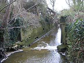
Baybridge Canal facts for kids
Quick facts for kids Baybridge Canal |
|
|---|---|

The disused lock at the lower end of the canal
|
|
| Specifications | |
| Maximum boat length | 75 ft 0 in (22.86 m) |
| Maximum boat beam | 12 ft 6 in (3.81 m) |
| Locks | 2 |
| Status | reverted to river |
| History | |
| Date completed | 1826 |
| Date closed | 1875 |
| Geography | |
| Connects to | River Adur |
The Baybridge Canal was a short waterway built in Sussex, England. It was located entirely within the area of West Grinstead. The canal opened in 1826 and closed in 1875.
History of the Baybridge Canal
The River Adur is formed by two smaller rivers joining together. These are the Western Adur and the Eastern Adur. They meet near a place called Henfield. The Western branch starts near Slinfold and flows through Shipley and West Grinstead. The Eastern branch begins on Ditchling Common. It flows through Haywards Heath and Burgess Hill.
After the two branches join, the river flows for about 17.4 kilometers (10.8 miles). It eventually reaches the English Channel at Shoreham-by-Sea. In 1807, a special law called an act of Parliament was passed. This law helped to make the river better for boats and for draining water. Because of this, barges could travel up to Bines Bridge on the Western Adur.
In 1824, an engineer named May Upton created a plan. He wanted to extend the river navigation north to West Grinstead. This project was estimated to cost almost £6,000. His plan led to another act of Parliament in 1825. This new law created the Baybridge Canal Company.
Seven people were named as owners of the company. These included important figures like Lord Selsey. The company was allowed to raise £6,000 by selling shares. They could also borrow an extra £3,000 if needed. Even though it was called a canal, it mostly followed the path of the river. It went all the way to West Grinstead. The canal ended at a special loading area called a wharf. This wharf was near the main road from Worthing to Horsham, which is now the A24.
The canal stretched for about 5.6 kilometers (3.5 miles). It ran from Bines Bridge to the wharf at Baybridge. There were two locks on the canal. Locks are like water elevators that help boats move between different water levels. These locks were built for boats that were about 22.8 meters (75 feet) long and 3.8 meters (12.5 feet) wide. Each lock could raise or lower boats by about 2.1 meters (7 feet).
All of the canal was built within the area of West Grinstead. The construction work was finished in 1826. The main goods transported on the canal were manure, coal, and chalk. The Baybridge Canal closed on September 1, 1875. This was because new railways offered faster ways to transport goods. The canal was not used much after the railway from Shoreham to West Grinstead opened in 1861.
Canal's Path
The waterway had two special bridges. One was a swing bridge, which could swing open to let boats pass. This was located just above the lower lock. The other was a lift bridge at Hatterell Farm, which could be lifted up. Today, both of these have been replaced with fixed bridges that do not move.
The Environment Agency has a station at the Hatterell Farm bridge. This station measures how much water flows in the river. Up to 2005, the river's average flow was about 101.9 million liters (22.43 million gallons) per day.
Places of Interest Along the Canal
| Point | Coordinates (Links to map resources) |
OS Grid Ref | Notes |
|---|---|---|---|
| Bay Bridge wharf | 50°58′27″N 0°20′25″W / 50.9741°N 0.3402°W | TQ166207 | Start of navigation |
| Butchers Row bridge | 50°58′22″N 0°20′03″W / 50.9727°N 0.3341°W | TQ170205 | |
| Hatterell Farm bridge | 50°57′54″N 0°19′25″W / 50.9650°N 0.3235°W | TQ178197 | once a lift bridge |
| Locks bridge | 50°57′20″N 0°19′18″W / 50.9556°N 0.3218°W | TQ179186 | once a swing bridge |
| Lower lock | 50°57′13″N 0°19′20″W / 50.9536°N 0.3222°W | TQ179184 | End of navigation |
| Bines Green bridge | 50°56′43″N 0°18′29″W / 50.9452°N 0.3081°W | TQ189175 | River tidal below here |
 | Charles R. Drew |
 | Benjamin Banneker |
 | Jane C. Wright |
 | Roger Arliner Young |

