Bay Point, California facts for kids
Quick facts for kids
Bay Point
|
|
|---|---|

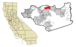
Location in Contra Costa County and the state of California
|
|
| Country | |
| State | |
| County | Contra Costa |
| Area | |
| • Total | 7.44 sq mi (19.28 km2) |
| • Land | 6.43 sq mi (16.64 km2) |
| • Water | 1.02 sq mi (2.64 km2) 11.7% |
| Elevation | 89 ft (27 m) |
| Population
(2020)
|
|
| • Total | 23,896 |
| • Density | 3,718.64/sq mi (1,435.74/km2) |
| Time zone | UTC-8 (PST) |
| • Summer (DST) | UTC-7 (PDT) |
| ZIP code |
94565
|
| Area code(s) | 925 |
| FIPS code | 06-04415 |
| GNIS feature IDs | 1853376, 2407808 |
Bay Point is a community in Contra Costa County, California. It is located in the East Bay area of the San Francisco Bay Area. Bay Point is found on the southern shore of Suisun Bay, west of Pittsburg, California, and northeast of Concord, California.
In 2020, about 23,896 people lived in Bay Point. The Bay Area Rapid Transit (BART) train system has a station nearby. A major road, State Route 4, also runs through the community. Bay Point does not have its own police department because it is an unincorporated area. This means it is not officially a city. The California Highway Patrol and the Contra Costa County Sheriff's Office help keep the community safe.
Contents
Bay Point's Location and Land
Bay Point covers about 7.4 square miles (19.28 square kilometers). Most of this area is land, but about 11.7% is water. Bay Point is right next to Suisun Bay. A part of Bay Point in the northwest is called Shore Acres.
People Living in Bay Point
| Historical population | |||
|---|---|---|---|
| Census | Pop. | %± | |
| 2020 | 23,896 | — | |
| U.S. Decennial Census | |||
In 2010, there were 21,349 people living in Bay Point. The community is very diverse, with people from many different backgrounds. Most people live in homes, and only a small number live in group housing.
Bay Point's History
Bay Point has had a few different names over the years. It was once called Bella Vista. For a long time, until 1993, it was known as West Pittsburg. People sometimes got West Pittsburg confused with a different part of the nearby city of Pittsburg.
In 1993, the community held a vote to change its name back to Bay Point. This was a historical name for the area. Bay Point is still an unincorporated community, just like it was when it was called West Pittsburg.
Ambrose Park: A Community Hub
In 2008, the city of Pittsburg officially added Ambrose Park to its area. However, the Ambrose Parks and Recreation District still manages the park. This district has been in charge of the park since 1946.
The main reason for this change was to get more funding and resources from Pittsburg. This helped build a new swimming pool at the park. The new Ambrose Aquatic Center opened on July 4, 2016.
Ambrose Park is a great place for outdoor activities. It has areas for picnics, tennis courts, basketball courts, and hiking trails. The park covers 12.3 acres of land. It was given to the community by the Enes family in 1947.
Schools in Bay Point
Most students in Bay Point attend schools in the Mount Diablo Unified School District. A smaller number of students go to schools in the Pittsburg Unified School District.
In 1940, Ambrose Elementary was the only local school. High school students had to go to Pittsburg. Today, Bay Point has several public schools:
- Riverview Middle School (for grades 6–8)
- Rio Vista Elementary School (for grades K-5)
- Shore Acres Elementary School (for grades K-5)
- Bel Air Elementary School (for grades K-5)
A branch of the Contra Costa County Library is also located in Bay Point, inside Riverview Middle School.
See also
In Spanish: Bay Point (California) para niños


