Bear Garden Mountain facts for kids
Quick facts for kids Bear Garden Mountain |
|
|---|---|
| Highest point | |
| Elevation | 1,566 ft (477 m) |
| Geography | |
| Location | Frederick County, Virginia / Hampshire County, West Virginia, U.S. |
| Parent range | Ridge-and-Valley Appalachians |
| Topo map | USGS Capon Bridge |
| Climbing | |
| Easiest route | Hike, Drive |
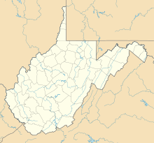
Bear Garden Mountain is a beautiful, forested mountain. It's like a long, narrow hill called a ridge. This ridge is part of the big Ridge-and-Valley Appalachians mountain range. You can find Bear Garden Mountain in two states: West Virginia, specifically Hampshire County, and Virginia, in Frederick County.
Where is Bear Garden Mountain?
Bear Garden Mountain stretches for many miles. It runs from the northern part of Frederick County in Virginia all the way to Hampshire County in West Virginia. The mountain ends near a small town called Capon Bridge.
The State Border
A part of Bear Garden Mountain is very special. About 2.5 miles (4 kilometers) of the mountain ridge forms the border between Virginia and West Virginia. So, if you stand on that part of the mountain, you could have one foot in each state!
Roads Crossing the Mountain
Two main roads cross over Bear Garden Mountain.
- One is the Northwestern Turnpike, also known as U.S. Route 50. It crosses the mountain just east of Capon Bridge.
- The other road is the Bloomery Pike. This road is also called West Virginia Route 127 or State Route 127 and goes through a place called Good.
 | Toni Morrison |
 | Barack Obama |
 | Martin Luther King Jr. |
 | Ralph Bunche |


