
Bearhat Mountain facts for kids
Quick facts for kids Bearhat Mountain |
|
|---|---|

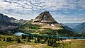
Bearhat Mountain with mountain goats
|
|
| Highest point | |
| Elevation | 8,689 ft (2,648 m) |
| Prominence | 1,084 ft (330 m) |
| Geography | |

Bearhat Mountain
Location in Montana

Bearhat Mountain
Location in the United States
|
|
| Location | Flathead County, Montana, U.S. |
| Parent range | Lewis Range |
| Topo map | USGS Mount Cannon, MT |
| Climbing | |
| First ascent | 1923 (Norman Clyde) |
Bearhat Mountain is a tall peak in Glacier National Park, Montana, U.S. It stands at 8,689 feet (2,648 m) high. This mountain is found in the Lewis Range and is right next to Hidden Lake.
The mountain was named after a Kootenai Native American person. The name was officially recognized in 1932.
Climate and Weather
Bearhat Mountain has an alpine climate. This means it has very long and cold winters. Summers are short and can be cool or mild.
Temperatures can drop very low, sometimes even below −10 °F. With the wind, it can feel like −30 °F or colder!
How Bearhat Mountain Formed
Like other mountains in Glacier National Park, Bearhat Mountain is made of sedimentary rock. This rock formed a very long time ago in shallow seas.
About 170 million years ago, a huge event happened. A massive slab of ancient rock, called the Lewis Overthrust, was pushed over younger rock. This slab was about 3 mi (4.8 km) thick, 50 miles (80 km) wide, and 160 miles (260 km) long. This powerful movement helped create the mountains we see today.
Pictures of Bearhat Mountain
-
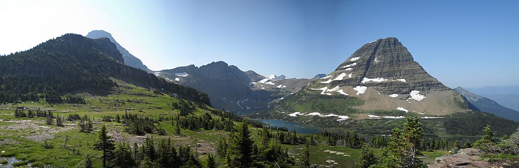
A wide view with Bearhat Mountain on the right. Hidden Lake is below, and Reynolds Mountain is on the far left.
-
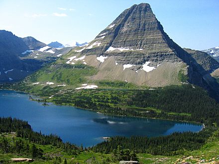
Bearhat Mountain rising high above Hidden Lake.
-
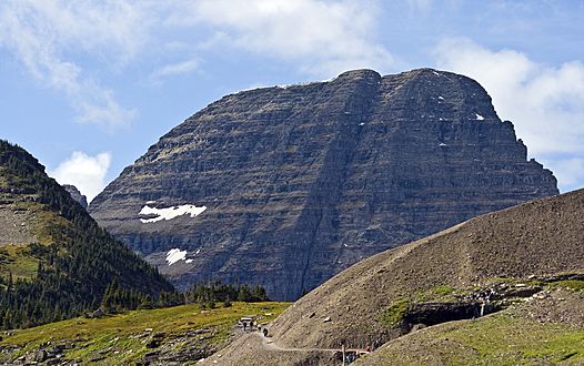
Bearhat Mountain seen from the Hidden Lake trail.

.jpg)

More Images
-
A panorama showing Bearhat Mountain with Hidden Lake below.
-
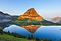
Bearhat Mountain reflected in the calm waters of Hidden Lake at sunrise.
-
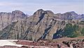
The south side of Bearhat Mountain, showing its highest point.

.jpeg)

