Beauharnois Canal facts for kids
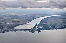
The Beauharnois Canal is a really important waterway in southwestern Quebec, Canada. It's a key part of the Saint Lawrence Seaway, which helps ships travel across North America.
This canal connects two large lakes: Lake Saint-Francis and Lake Saint-Louis. It helps ships get around fast-moving parts of the Saint Lawrence River called rapids. The canal passes through several towns like Salaberry-de-Valleyfield and Beauharnois.
Contents
Building the Beauharnois Canal
The very first Beauharnois Canal opened way back in 1843. It was about 24 km (15 mi) long. This early canal was built on the south side of the St. Lawrence River. It was made to replace an even older canal called the Coteau-du-Lac canal.
Later, in 1899, a new canal called the Soulanges Canal was built on the north side of the river. This made the original Beauharnois Canal less important.
The Modern Canal
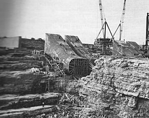
The canal we see today was built between 1929 and 1932. It's also on the south side of the St. Lawrence River. This modern canal is 24.5 kilometres (15.2 mi) long. It's also very deep (8 metres (26 ft)) and wide (182 metres (597 ft)).
This canal was built for a special reason: to create hydroelectric power. A large dam and power station were built here. They use the 24 metres (79 ft) drop in water level between Lake St. Francis and Lake St. Louis to make electricity. Some of this electricity helps power a big aluminum factory in Beauharnois.
Locks and the Seaway
In the 1950s, two special sections called locks were added to the Beauharnois Canal. These locks are like water elevators for ships. They were built as part of the huge Saint Lawrence Seaway project. The locks opened in 1959.
Thanks to these locks, very large ships, up to 27,000 tons, can now travel easily between Lake St. Francis and Lake St. Louis. This also meant that the Soulanges Canal was no longer needed for big ships.
Bridges Over the Canal
Many bridges cross the Beauharnois Canal, helping people and trains get from one side to the other. Here are some of them, listed as you would see them if you were traveling downstream:
- The Larocque Bridge carries two main roads, Routes 132 and 201. It connects Salaberry-de-Valleyfield with Saint-Stanislas-de-Kostka.
- The St. Louis Bridge connects Salaberry-de-Valleyfield with Saint-Louis-de-Gonzague.
- The Madeleine Parent Bridge carries a major highway called Autoroute 30.
- The Pied-du-Canal or Penn Central Bridge is a railroad bridge for trains.
- The Boulevard Edgar Hébert Bridge carries Route 132. This crossing is interesting because it includes a suspension bridge over the power station's water discharge and a tunnel that goes under the canal's locks!
 | Jewel Prestage |
 | Ella Baker |
 | Fannie Lou Hamer |


