Beelu National Park facts for kids
Quick facts for kids Beelu National ParkWestern Australia |
|
|---|---|
|
IUCN Category II (National Park)
|
|

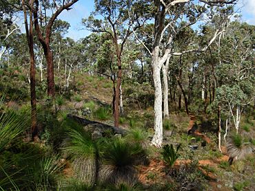
Helena River valley hillside
|
|
| Nearest town or city | Mundaring |
| Established | 1995 |
| Area | 46.17 km2 (17.8 sq mi) |
| Managing authorities | Department of Environment and Conservation |
| Website | Beelu National Park |
| See also | List of protected areas of Western Australia |
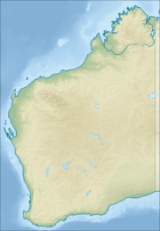
Beelu National Park is a special place located east of Perth, Western Australia. It's found south of Mundaring, Western Australia, and west of the Mundaring Weir Road. This park is part of a group of parks called the Parks of the Darling Range. It's a fantastic spot to discover nature and learn about the local environment.
Contents
History of Beelu National Park
Beelu National Park was officially created in 1995. At first, it was known as Mundaring National Park. The government established it to help protect important old forests.
In 2008, the park's name was changed to Beelu National Park. This change was made to honor the traditional owners of the land. These are the Noongar people. The word "Beelu" means "river" or "stream" in their language. The Beelu people lived in this area for a very long time. Their traditional lands were around the Helena River, Swan River, and Canning River.
Plants and Trees You Can See
Beelu National Park is home to many amazing native plants. You can find tall jarrah and marri trees here. These are two of the most common trees in Western Australia.
Other interesting plants include Zamia (a type of cycad), Bull Banksia, and sheoak trees. You might also spot grass trees, which look like spiky plants with a tall flower stalk. The park is a great place to see these unique Australian plants.
Fun Things to Do at Beelu National Park
Beelu National Park offers many activities for visitors. It's a great place to spend time outdoors.
Park Facilities
The park has several useful facilities for visitors. You can find clean toilets and picnic tables. There are also wood barbecues if you want to cook your own food.
Trails for Exploring
If you love being active, you'll enjoy the park's trails. There are many different paths for hiking and mountain biking. These trails let you explore the beautiful bushland.
Perth Hills National Parks Centre
Inside the park, you'll find the Perth Hills National Parks Centre. This center is open from 10:00 AM to 4:00 PM. Here, you can get advice about the park and even buy refreshments. It's a good place to start your visit.
Scenic Lookouts and Special Trees
There's a lookout called South Ledge. From here, you get an amazing view over Mundaring Weir and Lake CY O'Connor. It's a perfect spot for photos.
You can also visit Fred Jacoby Park within Beelu National Park. This area is home to the largest oak tree in all of Western Australia!
Camping in the Park
If you want to stay longer, there are two campsites available in the park. Camping lets you experience the park's nature day and night.
Images for kids
 | May Edward Chinn |
 | Rebecca Cole |
 | Alexa Canady |
 | Dorothy Lavinia Brown |


