Mundaring, Western Australia facts for kids
Quick facts for kids MundaringPerth Western Australia, Western Australia |
|||||||||||||||
|---|---|---|---|---|---|---|---|---|---|---|---|---|---|---|---|

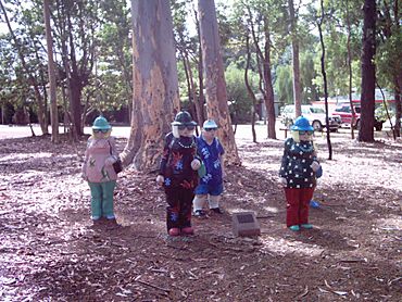
Statues in Sculpture Park, Mundaring
|
|||||||||||||||
| Established | 1890s | ||||||||||||||
| Postcode(s) | 6073 | ||||||||||||||
| LGA(s) | Shire of Mundaring | ||||||||||||||
| State electorate(s) | Kalamunda | ||||||||||||||
| Federal Division(s) | Hasluck | ||||||||||||||
|
|||||||||||||||
Mundaring is a suburb found about 34 kilometers (21 miles) east of Perth, Western Australia. It sits along the Great Eastern Highway. Mundaring is part of the Shire of Mundaring. The name "Mundaring" comes from an Aboriginal word, "Mindah-lung." This word means "a high place on a high place." The area is also known as part of the beautiful Perth Hills.
Contents
Local News and Newspapers
Mundaring has its own local newspapers. These papers help keep everyone in the community informed. They share news about local events and important happenings. Some examples include the Chidlow Chatter and the Darlington Review. There are also weekly papers like Echo Newspapers.
The Railway History
Mundaring once had an important railway line. This line was part of the Eastern Railway. It passed through Mundaring on its first route to Chidlow. The Mundaring railway station was very important. It helped with building the famous Mundaring Weir.
Later, a second railway route was built. The old Mundaring line still helped out. It was used when there were problems on the new line. The line through Mundaring was also called the Mundaring Loop. It closed in 1954. Today, parts of the old railway are now the Railway Reserve Heritage Trail. This trail is great for walking and cycling. The Mundaring Hotel opened in 1899. It was right across from the railway station.
Mundaring Geophysical Observatory
From 1959 to 2000, Mundaring was home to a special observatory. This was the Mundaring Geophysical Observatory. It was run by Geoscience Australia. The observatory's job was to record earthquakes. It kept track of all the seismic activity in Western Australia. This helped scientists understand the Earth's movements.
Environment and Wildlife
Mundaring is a special place for birds. It is part of the Mundaring-Kalamunda Important Bird Area. This area is very important for long-billed black cockatoos. These cockatoos use the area to rest and find food. They visit during their non-breeding season. Protecting this area helps these unique birds survive.
Transport Options
You can get around Mundaring using local buses.
- The 320 bus goes from Mundaring to Midland Station. It travels along Craig Street, Mundaring Weir Road, and Great Eastern Highway.
- The 331 bus goes from Mundaring to Wundowie. It uses Craig Street, Mundaring Weir Road, and Stoneville Road.
 | Dorothy Vaughan |
 | Charles Henry Turner |
 | Hildrus Poindexter |
 | Henry Cecil McBay |

