Railway Reserves Heritage Trail facts for kids
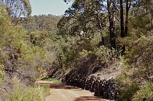
The Railway Reserves Heritage Trail is a special path in the Shire of Mundaring in Western Australia. You might also hear it called the Bridle Trail or Bridle Track by local people. It's a great place for walking, cycling, and horse riding.
Contents
What is the Railway Reserves Heritage Trail?
This trail is made up of two main parts: a big loop and a straight line. The loop goes between Bellevue and Mount Helena. It's about 40.8 km (25.4 mi) long.
The Trail Loop: Two Historic Routes
The loop follows two old railway lines that used to be part of the Eastern Railway. They both start from Bellevue and meet up again in Mount Helena.
- The southern path, called the First Route, opened in 1884. It goes through Mundaring.
- The northern path, called the Second Route, opened in 1896. It passes through the beautiful John Forrest National Park.
The Eastern Extension: Beyond the Loop
From Mount Helena, the Railway Reserves Heritage Trail continues as a straight line. This part is called the Eastern Extension and is about 22.5 km (14.0 mi) long. It goes all the way to Wooroloo. This section is also part of the longer 75-kilometre-long (47 mi) Kep Track, which continues even further to Northam.
In Kalamunda, there's another railway heritage trail. It follows the path of the old Upper Darling Range Railway.
Why was the Trail Created?
The trail was created after the old railway lines closed down. The Western Australian Government Railways (WAGR) stopped using these lines in 1966. This happened because a new, more modern railway line was built.
The Old Railway Lines
The first two attempts to build the Eastern Railway from Bellevue to Chidlow, Western Australia were tricky. They were built before 1900. The problem was that the hills were too steep for the heavy trains. Eventually, a new line was built through the Avon Valley. This new line had gentler slopes.
What Happened to the Old Lines?
After the old railway lines closed, the land was given to the Mundaring Council. Most of the railway equipment, like rails, sleepers (the wooden blocks under the rails), and buildings, were removed. However, some interesting things still remain:
- The old concrete railway platforms in Mundaring and Darlington are still there.
- A few old telegraph poles can still be seen.
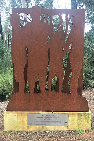
- The Koongamia platform, which was only used for about five years, was rebuilt as a public sculpture.
- The stationmaster's houses in Mundaring and Glen Forrest were saved. The Mundaring house is now the office for the Mundaring and Hills Historical Society.
Over the years, some parts of the old railway paths have changed. New roads, power lines, and communication cables have been added. But in some areas, old roads like "Railway Terrace" still run next to the trail.
How the Trail Was Funded
In 1988, Australia celebrated its 200th birthday, called the Australian Bicentenary. As part of this celebration, the Australian and Western Australian governments funded 17 Heritage Trails. The Railway Reserves Heritage Trail was one of them. It was developed by the Mundaring Bicentennial Community Committee. They also created a pamphlet and signs for the trail.
What is the Trail Like Today?
The trail is a mix of different environments. Some parts are very important for wildlife. They act as a "wildlife corridor," helping animals move safely between different natural areas. Other parts of the trail have been affected by erosion or bushfires.
The trail goes through the beautiful John Forrest National Park. It's one of many paths you can explore in the park. The Mundaring Shire receives money to keep the trail in good condition. This is so people can use it for walking, cycling, and horse riding. However, sometimes motorbikes illegally use the trail, which can be a problem.
Nature and Environment Along the Trail
The two old railway routes followed natural waterways. The first route followed Nyaania Creek, which flows into the Helena River. The second route followed Jane Brook, which joins the Swan River.
Different sections of the trail have important natural features. They show examples of the plants and animals found in the region. The entire trail acts as a vital Wildlife corridor. It connects many nearby parks and nature reserves, helping animals and plants thrive.
Parks and Reserves Connected by the Trail
- First Route (southern section):
* Greenmount National Park * Darlington Recreation Ground * Binbrook Park * Glen Forrest Super Block * Strettle Road Reserve * State Forest - Sawyers Valley
- Second Route (northern section):
* John Forrest National Park * Brookside Park * Milligan Park * Leschenaultia Conservation Reserve * Beechina Nature Reserve * Beechina North Nature Reserve * Needham Nature Reserve
The trail also passes through or connects to other named parks and reserves:
- Whybourne Park - Bellevue
- Darlington Station Reserve - Darlington
- M.J. Morgan Reserve - Glen Forrest
- Thomas Park - Glen Forrest
- Sculpture Park - Mundaring
- Jarrah Creek Reserve - Sawyers Valley
- Chidlow Recreation Reserve - Chidlow
Trek the Trail Event
"Trek the Trail" is a fun, free event held every September. It's a walking and cycling event along a part of the Railway Reserves Heritage Trail. This yearly event is organized by the Shire of Mundaring, Mundaring Arts Centre, Mundaring Tourism Association, and the Mundaring and Hills Historical Society. It encourages people to enjoy art, entertainment, local history, and the challenge of the trail.
The event changes its location each year. For example, in 2004, it went from Wooroloo to Chidlow. In 2010, it was from Parkerville to Swan View.
Distances Along the Trail
Signs along the trail at most road crossings show you how far it is to the next few places. Here are some distances along the loop:
- Pechey Road, Swan View 00.0 km
- Swan View Tunnel eastern entrance 1.2 km
- Parkerville 8.9 km
- Stoneville 11.9 km
- Mount Helena 15.9 km
- Sawyers Valley 19.0 km
- Mundaring 22.6 km
- Coppin Road, Mundaring 24.1 km
- Bailey Road, Glen Forrest 27.8 km
- Hardey Road, Glen Forrest 29.0 km
- Darlington 31.7 km
- Boya 34.0 km
- Scott Road, Greenmount 35.7 km
- RSL Hall, Bellevue 35.7 km
Cycling on the Trail
The Railway Reserves Heritage Trail is a "shared trail." This means that cyclists, horse riders, and people walking all use the same path. The Department for Planning and Infrastructure even suggests routes that use parts of this trail for cycling.
Where to Find More Information
There are pamphlets and websites available if you want to learn more about the trail. An older pamphlet, "Bikewest Mountain Bike Maps - Railway Reserve Trail," suggests starting near the Morrison Road-Pechey Road intersection in Swan View. It includes a map, details about the terrain, and a short history. The Mundaring Shire also produces a newer pamphlet linked to their website.
 | Bayard Rustin |
 | Jeannette Carter |
 | Jeremiah A. Brown |


