
Kalamunda, Western Australia facts for kids
Quick facts for kids KalamundaPerth, Western Australia |
|||||||||||||||
|---|---|---|---|---|---|---|---|---|---|---|---|---|---|---|---|

Kalamunda Road, Kalamunda
|
|||||||||||||||
| Established | 1901 | ||||||||||||||
| Postcode(s) | 6076 | ||||||||||||||
| Area | 10.6 km2 (4.1 sq mi) | ||||||||||||||
| Location | 25 km (16 mi) from Perth | ||||||||||||||
| LGA(s) | City of Kalamunda | ||||||||||||||
| State electorate(s) | Kalamunda | ||||||||||||||
| Federal Division(s) | Hasluck | ||||||||||||||
|
|||||||||||||||
Kalamunda (which is also known as Nyungar: Karlamarda in the Noongar language) is a town and eastern suburb of Perth, Western Australia. It is located in the Darling Scarp, which is a range of hills, right at the eastern edge of the Perth city area.
Contents
History of Kalamunda
Indigenous Noongar people were the very first people to live in the Kalamunda area. The first European settlers to stay permanently were Frederick and Elizabeth Stirk and their family. They arrived in 1881. They built a property called Headingly Hill, which is now Stirk Park. Their old house, Stirk Cottage, is now a museum you can visit.
More settlers moved to the area in the 1890s. This was helped by the new Kalamunda Zig Zag railway line. At this time, the Kalamunda area was actually known as "Gooseberry Hill".
The name Kalamunda was officially chosen on 13 December 1901. Thirty-two local residents asked for a townsite to be formed. They wanted the name "Calamunnda". This name comes from two words in the local Noongar language. Bishop Rosendo Salvado recorded these words in a book. Cala means "fire", "home", "district", or "settlement". Mun-da means "forest" or "bush".
The Surveyor-General, Harry Johnston, changed the spelling to "Kalamunnda". By 1901, it was changed again to "Kalamunda". The local government area's unofficial motto is "A home in the forest". This motto fits perfectly with the meaning of its name!
Kalamunda's Environment
Geography of the Area
Kalamunda is about 300 metres (980 ft) (or 984 feet) above sea level. Because it's so high up, Kalamunda and the areas around it have colder nights than most of the Perth city area to the west. The deep clay soils in the valleys here are great for growing certain fruits. These include stone fruits (like peaches and plums), apples, and pears. It's also good for making wine and for a small business that grows roses.
The suburb of Gooseberry Hill is just north of Kalamunda. The land there drops down sharply into the Helena Valley. This makes Kalamunda feel a bit separate from other towns in the Darling Scarp to the north. To the south and east, the town area slowly changes into more rural places. These areas have orchards and include Bickley, Carmel, and Pickering Brook. Beyond these, you'll find large forests of jarrah and marri trees.
Close by, you can find the Kalamunda National Park. This is also where the Bibbulmun Track begins. The Bibbulmun Track is a very long walking trail, stretching for 963 kilometers (about 598 miles)!
Important Bird Area
Kalamunda is part of a special place called the Mundaring-Kalamunda Important Bird Area. BirdLife International has identified this area as important because it's a key spot for Long-billed Black Cockatoos. These cockatoos use the area to rest and find food when it's not their breeding season.
Kalamunda's Climate
Kalamunda has a Mediterranean climate. This means it has hot, dry summers and cool, wet winters. Because the suburb is high up, around 250–300 metres (820–980 ft) (or 820-984 feet) above sea level, and located on the Darling Scarp, it is a few degrees cooler in winter than Perth city.
However, this temperature difference is not as big in summer. This is because Kalamunda is less affected by the regular afternoon sea breeze, known as the Fremantle Doctor. This breeze cools down Perth, but Kalamunda is further inland. Kalamunda gets much more rain than the city, with over 1,000 millimetres (39 in) (about 39 inches) of rain each year. This is because of its location in the Darling Scarp, which causes an effect that brings more rain.
| Climate data for Kalamunda | |||||||||||||
|---|---|---|---|---|---|---|---|---|---|---|---|---|---|
| Month | Jan | Feb | Mar | Apr | May | Jun | Jul | Aug | Sep | Oct | Nov | Dec | Year |
| Mean daily maximum °C (°F) | 30.4 (86.7) |
30.3 (86.5) |
27.7 (81.9) |
23.8 (74.8) |
19.0 (66.2) |
16.4 (61.5) |
15.4 (59.7) |
16.3 (61.3) |
18.3 (64.9) |
20.6 (69.1) |
24.5 (76.1) |
28.0 (82.4) |
22.6 (72.7) |
| Mean daily minimum °C (°F) | 16.2 (61.2) |
16.3 (61.3) |
15.3 (59.5) |
13.4 (56.1) |
10.8 (51.4) |
9.1 (48.4) |
8.0 (46.4) |
8.1 (46.6) |
9.2 (48.6) |
10.1 (50.2) |
12.5 (54.5) |
14.6 (58.3) |
12.0 (53.6) |
| Average precipitation mm (inches) | 11.9 (0.47) |
17.4 (0.69) |
22.7 (0.89) |
55.7 (2.19) |
144.3 (5.68) |
216.2 (8.51) |
213.8 (8.42) |
165.9 (6.53) |
102.1 (4.02) |
70.5 (2.78) |
28.6 (1.13) |
19.6 (0.77) |
1,063.3 (41.86) |
| Average precipitation days | 2.5 | 2.6 | 3.9 | 7.0 | 13.3 | 16.6 | 18.5 | 16.5 | 13.1 | 10.9 | 6.2 | 3.7 | 114.8 |
Transport in Kalamunda

Kalamunda Road is a very important road. It helps people get to Perth Airport. It also connects the suburbs in the foothills to the main Perth city center.
The suburb has its own Kalamunda bus station. From here, you can catch buses to many different parts of the Perth city area.
Kalamunda was once a busy area for cutting down trees (logging). Kalamunda railway station was the biggest station on the Upper Darling Range Railway. Because of this old railway, there are still some interesting features in the area today. There's a museum where the original station used to be. You can also see special road structures that were built next to the railway. The Kalamunda Zig Zag road follows the old railway line where it climbed up the Darling Scarp. At Gooseberry Hill, the railway used to go down from the hills to Midland Junction. It dropped 300 meters (about 984 feet) using a series of five zig-zag turns! The old railway line has now been turned into a one-way scenic drive.
Bus Services
Bus Stations
- Kalamunda Bus Station
Bus Routes
- 272 Kalamunda Bus Station to Kalamunda Community Centre – serves Mead Street and Crescent Road
- 273 Kalamunda Bus Station to Kalamunda Bus Station – This is a circular route, serving Canning Road, Recreation Road, Peet Road and Cotherstone Road
- 274 Kalamunda Bus Station to Gooseberry Hill – serves Mead Street and Railway Road
- 275 Walliston to High Wycombe Station – serves Canning Road, Railway Road, Mead Street, Kalamunda Bus Station and Kalamunda Road
- 276 Kalamunda Bus Station to High Wycombe Station – serves Mead Street and Railway Road
- 279 Kalamunda Bus Station to Maddington Central – serves Canning Road and Lesmurdie Road
- 282 Kalamunda Bus Station to Elizabeth Quay Bus Station – serves Canning Road
- 283 Kalamunda Bus Station to Elizabeth Quay Bus Station – serves Canning Road and Lesmurdie Road
- 307 Kalamunda Bus Station to Midland Station – serves Mead Street and Railway Road
Facilities in Kalamunda
Kalamunda has many areas with orchards. These farms mainly grow apples and stone fruit like peaches and plums. The town mostly serves as a "dormitory suburb" for people who work in Perth. This means many people live in Kalamunda but travel to Perth for their jobs.
Kalamunda has a good number of shops, government services, and schools. It also has a small industrial area. The town's shopping center is the biggest in the Darling Scarp. However, it mainly serves Kalamunda and the nearby towns of Lesmurdie and Walliston.
Kalamunda and the areas around it have a strong tradition of arts and crafts. It is also home to three major residential colleges in Perth. Groups that work to protect nature are very active in the community. They have worked hard, and mostly successfully, to keep native plants and trees next to and even within the town area.
Kalamunda is where you'll find the television towers for all the free-to-air Perth TV stations. It also has the radar system that helps guide planes approaching Perth Airport.
Kalamunda's Population
In the 2016 census, Kalamunda had a population of 6,970 people. About 48.3% were male and 51.7% were female. The average age of people living in Kalamunda was 47 years old. The average weekly personal income was $676. Aboriginal and/or Torres Strait Islander people made up 0.7% of the population.
When asked about their religion in the 2016 census, the most popular choices were: No Religion (33.1%), Catholic (22.4%), and Anglican (18.8%). About 9.0% didn't state their religion. Overall, Christianity was the largest religious group, with 61.4% of people identifying as Christian (not including those who didn't state their religion).
The people living in Kalamunda are a bit older on average than those in the wider Perth city area. The average age in Kalamunda is 47, compared to 36 for the Perth Metropolitan area. It's likely that over time, Kalamunda will become a popular place for retired people to live. The population of Kalamunda and its surrounding areas is quite diverse. For example, there are many Italian families who moved here after World War II and became involved in the orchard industry.
Even though the city is slowly growing closer to Kalamunda, which has made it feel less like a separate "regional center," Kalamunda is still a quiet town. It is nestled among the jarrah forests on the Darling Scarp.
More and more, Kalamunda is becoming a place for short stays and eco-tourism. People can visit and enjoy the forest setting, which is close to Perth. This attracts both local visitors and tourists from other countries.
Gallery
-
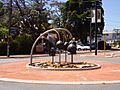
The gum nut fountain
-
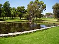
Stirk Park


