Forrestfield, Western Australia facts for kids
Quick facts for kids ForrestfieldPerth, Western Australia |
|||||||||||||||
|---|---|---|---|---|---|---|---|---|---|---|---|---|---|---|---|

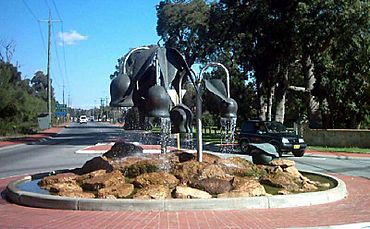
Roundabout at entrance to Hartfield Park
|
|||||||||||||||
| Postcode(s) | 6058 | ||||||||||||||
| LGA(s) | City of Kalamunda | ||||||||||||||
| State electorate(s) | Forrestfield | ||||||||||||||
| Federal Division(s) | Hasluck | ||||||||||||||
|
|||||||||||||||
Forrestfield is a suburb in Western Australia. It's part of the City of Kalamunda and is located about 15 kilometers southeast of Perth. You can find it at the bottom of the Darling Scarp hills, right next to the southern edge of Perth Airport.
A major road called Roe Highway divides Forrestfield. The southern part is where people live, with houses and neighborhoods. The northern part is an industrial area, full of businesses and factories. Forrestfield is also close to other suburbs like Wattle Grove, Cloverdale, and Kalamunda.
Contents
Forrestfield's Industrial Zone
The northern part of Forrestfield is a busy industrial area. It's home to many businesses and important transport hubs.
Train Hub and Freight Yards
This area has a very large train hub called the Forrestfield Marshalling Yard. It's a huge place, about 241 hectares, where trains are sorted and moved. This yard was built between 1968 and 1973 to replace older train yards in Perth. It works with the nearby Kewdale Freight Terminal.
Inside the yard, there are special places to fix and maintain train engines, carriages, and wagons. Today, several companies like Aurizon, SCT Logistics, and Watco Australia use this yard for their train operations. Gemco Rail also has a facility here.
Some parts of the land that were once used for railways are now used for other industrial businesses. Large companies like CBH Group and BlueScope have built big facilities here. Even truck makers like Kenworth and DAF Trucks moved their operations to Forrestfield in 2005.
New Transport Links and Growth
A big project called the Airport Line was built here. Construction started in 2016, and the train line opened on October 9, 2022. This line has three stations: Redcliffe, Airport Central, and High Wycombe.
This new train line is helping Forrestfield and the surrounding areas grow. It makes it easier for people to get to Perth Airport, which is a very important place for jobs, business, and international trade in Australia. Many different types of businesses operate in Forrestfield's industrial area, including moving companies and large retail groups.
A Look at Forrestfield's History
People started settling in the Forrestfield area in the late 1800s. Not many people lived here until the early 1900s. The population grew more between World War I and World War II.
After World War II, especially from the 1950s to the 1970s, Forrestfield grew very quickly. Since the early 1990s, the number of people living here has stayed about the same. This is because new homes were built, but fewer people lived in each home.
The name "Forrestfield" might come from John Forrest, who was Western Australia's first Premier (like a state leader). Or it could be named after his brother, Alexander Forrest. However, a local story says the name came from Charles Hale. He settled here in 1902 and planted crops among the native forest, which led to the name "Forrestfield." In 1921, a group called the Forrestfield Progress Association was formed, and the name appeared on maps by 1944.
Shopping in Forrestfield
Forrestfield has several places to shop for all your needs.
The main shopping center is the Forrestfield Forum and Marketplace. It's located at the corner of Hale Road and Strelitzia Avenue. This center has 52 shops, including big supermarkets like Coles and Woolworths.
Along Cumberland Road, you can find a Foodworks supermarket, a newsagency, and places to get your hair cut. There are also various dining options and fast-food restaurants. Around Forrestfield, you'll discover other shops like taverns, liquor stores, a plant nursery, and local delis.
Schools and Colleges
Forrestfield is home to several educational places for students of different ages:
- Darling Range Sports College (which used to be Forrestfield Senior High School)
- Dawson Park Primary School
- Forrestfield Primary School
- HillSide Christian College (formerly Forrestfield Christian School)
- Woodlupine Primary School
- Tabor College
Who Lives in Forrestfield? (Demographics)
According to the 2021 census, Forrestfield had a population of 13,181 people. This was split almost evenly, with 50.0% male and 50.0% female residents. The average age of people living in Forrestfield is 38 years old.
Fun Places and Facilities
Forrestfield has great amenities for sports, recreation, and outdoor activities.
The Hartfield Park Recreation Centre is a large complex. It has an indoor stadium and many outdoor playing fields for sports like cricket, rugby, Australian rules football, hockey, and soccer. There's also an 18-hole golf course and a place for horse riding. The park also features a nature conservation area and a lake, perfect for enjoying the outdoors.
If you're looking for a place to stay, Discovery Park - Perth Airport Caravan and Holiday Park is on Hale Road, just off Tonkin Highway.
Getting Around: Public Transport
Forrestfield is served by several bus routes, making it easy to travel to different parts of the suburb and beyond.
Bus Routes
- Route 270: Travels from High Wycombe Station to Elizabeth Quay Bus Station. It serves Hawtin Road and Hale Road.
- Route 271: Goes from High Wycombe Station to Forrestfield. This route covers Berkshire Road, Bougainvillea Avenue, Dawson Avenue, Hicks Street, Cypress Road, Hale Road, Anderson Road, Lewis Road, Jubilee Road, Cumberland Road, and Edinburgh Road.
- Route 280: Connects High Wycombe Station to Westfield Carousel. It uses Berkshire Road and Hale Road.
- Route 281: Runs from Darling Range Sports College to Lesmurdie Senior High School. It serves Berkshire Road and Hale Road.
- Route 293: Travels from High Wycombe Station to Redcliffe Station. This route uses Abernethy Road.
 | Aurelia Browder |
 | Nannie Helen Burroughs |
 | Michelle Alexander |

