Nyaania Creek facts for kids
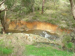
Nyaania Creek (31°55′S 116°03′E / 31.91°S 116.05°E) is a small creek in Western Australia. It's a seasonal creek, meaning it flows mainly during certain times of the year, usually after rain. The creek flows into the Helena River.
Nyaania Creek starts in Mahogany Creek. From there, it travels through several suburbs. These include Glen Forrest, Darlington, and Boya. Finally, it joins the Helena River in Helena Valley.
This creek was not always called Nyaania Creek. On old maps from 1902 to 1920, it was known as Smiths Mill Brook. Later, in the 1920s, people started calling it Nyaania Brook. The name officially changed to Nyaania Creek in 1945.
Contents
Where Nyaania Creek Flows
Nyaania Creek flows through many private properties. This means it's important to be careful about what goes into the water. Things like garden chemicals or too much fertilizer can harm the creek. Also, some plants that don't belong there can grow too much.
The creek also runs next to special nature areas. These areas are called reserves. Some parts of the creek follow the path of an old railway line. This old railway path is now part of the Railway Reserve Heritage Trail.
The Upper Part of the Creek
The creek is quite small and narrow in its upper sections. It winds through many private lands.
Near the start, on its north side, is the Strettle Road Reserve. This area is in Mahogany Creek. It's a special piece of land that has grown back after being used for logging and fires.
Further along, the creek enters its first official reserve. This is the Thomas Park reserve, located near the old Statham quarry in Glen Forrest.
In Glen Forrest, the Glen Forrest Super Block is on the south side of the creek. This is close to the border with Darlington. It's also near a famous spot called Devil's Terror.
Devil's Terror: A Tricky Spot
Nyaania Creek became very important during the building of the Eastern Railway. The railway builders faced big problems here. They were digging a cutting for the train tracks. Suddenly, they hit clay, and then an underground stream. The water mixed with the clay and created a huge, deep bog.
Newspapers in Perth in the 1880s called this spot The Devil's Terror. They wrote about workers sinking into the mud. It was a very difficult place to build.
How the Creek Was Moved
Because of the bog, the railway line had to be moved. It was shifted about 100 meters south. This new path followed the bed of Nyaania Creek.
To make way for the railway, the creek above Glen Forrest was diverted. Its water was sent into another brook called Chittawarra Brook. A dam was built across Nyaania Creek just west of Glen Forrest. This dam held back the water.
Workers then built a new, man-made channel for the creek. Once the channel was ready, the dam was opened. Nyaania Creek then flowed into its new path. Now, the creek runs along the top of a deep cutting. In winter, you can hear the water rushing above your head as you walk through the cutting.
The Persistent Springs
Even after the railway was built, springs kept flowing. These springs were under or next to the railway line. They continued to flow from the 1880s until the railway closed in 1953.
The train tracks were removed in the 1960s. But the springs are still there today! They keep flowing even when Nyaania Creek is dry during a drought. Many people who walk the Railway Reserve Heritage Trail find these persistent springs very interesting.
Lower Part of the Creek
After passing through the town of Darlington, the creek enters a steep valley. This valley is south of the riding school in Glen Road. Finally, Nyaania Creek flows into the Helena River in Helena Valley.
 | Roy Wilkins |
 | John Lewis |
 | Linda Carol Brown |


