Helena River facts for kids
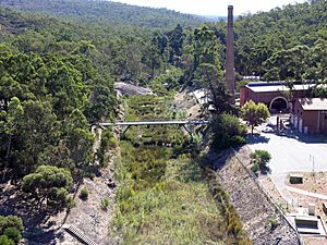
The Helena River is an important river in Western Australia. It flows into the Swan River. The Helena River starts in the hills near Mount Dale and flows northwest. It is held back by a large wall called a dam at Mundaring Weir.
After the dam, the river continues west. It passes through the western edge of the Darling Scarp, which is a range of hills. It flows between Gooseberry Hill and Greenmount Hill. Finally, it joins the Swan River near the historic town of Guildford, which is now a suburb.

Contents
Where the River Flows
The area where all the rain and smaller streams flow into the Helena River is called its catchment area. Many small streams flow into the Helena River. Some of these streams don't have names because they might dry up during parts of the year.
However, two important streams are Nyaania Creek on the north side and Piesse Brook on the south side. These streams flow through towns and can sometimes be affected by things like pollution from city areas.
Nature and Surroundings
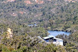
In the higher parts of its journey, the Helena River flows mostly through protected forests or special nature areas. This is good for the river! It helps keep the water clean and provides a green space between towns like Mundaring and Kalamunda.
The plants that grow in the Helena Valley are very special. There are many different kinds of plants, making the area rich in nature.
As the river gets closer to the Swan Coastal Plain, it passes through areas with houses and farms, like Darlington and Helena Valley. Further downstream, near Bellevue and Midland, the river has flowed past old industrial sites.
Important Dams
The Helena River has two main dams built on it. These dams help control the river's flow and store water.
Mundaring Weir
The most famous dam is Mundaring Weir. It's located higher up the river. This dam was a huge part of C.Y O'Connor's amazing Goldfields Water Supply Scheme. This scheme was built to send water all the way to the goldfields, which were very dry.
Lower Helena Pipehead Dam
The second dam is called the Lower Helena Pipehead Dam. It was built in the 1970s. Before this dam was built, the lower part of the Helena River, especially in East Guildford and Guildford, used to flood a lot. The Pipehead Dam has greatly reduced these floods.
Most of the water collected in the Pipehead Dam is actually pumped back up to Mundaring Weir. Because of this, there are rules about what activities can happen near the Pipehead Dam. These rules help protect the water quality, even though the dam is close to towns in the Shire of Mundaring.
River Bridges
Many bridges cross the Helena River. Their designs needed to be strong enough to handle large amounts of water, especially before the Pipehead Dam was built. In the early and mid-1900s, there were often big floods.
Here are some of the main bridges:
- Mundaring: Below Mundaring Weir Road. Built in 1965, it's made of strong concrete. It's about 48.76 meters long.
- Helena Valley: Scott Street. Built in 1933, this bridge is made of timber. It's about 44 meters long.
- Helena Valley: Roe Highway. Built in 1985, this bridge uses special concrete. It's about 54 meters long.
- Midland: Military Road. Built in 1952, this bridge is also made of timber. It's about 55.92 meters long.
- Woodbridge: Amherst Road. Built in 1969, this concrete bridge is about 73.4 meters long.
- East Guildford: Water Street, also known as Morrison Bridge. Built in 1964, this concrete bridge is about 70.12 meters long.
- Guildford: Great Eastern Highway / Johnson Street. Built in 1935, this timber bridge is about 92.95 meters long.
 | Selma Burke |
 | Pauline Powell Burns |
 | Frederick J. Brown |
 | Robert Blackburn |


