Bel Air South, Maryland facts for kids
Quick facts for kids
Bel Air South, Maryland
|
|
|---|---|

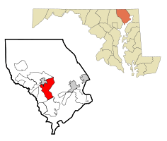
Location of Bel Air South, Maryland
|
|
| Country | United States |
| State | Maryland |
| County | Harford |
| Area | |
| • Total | 21.37 sq mi (55.34 km2) |
| • Land | 21.27 sq mi (55.10 km2) |
| • Water | 0.09 sq mi (0.24 km2) |
| Elevation | 350 ft (110 m) |
| Population
(2020)
|
|
| • Total | 57,648 |
| • Density | 2,709.66/sq mi (1,046.22/km2) |
| Time zone | UTC−5 (Eastern (EST)) |
| • Summer (DST) | UTC−4 (EDT) |
| FIPS code | 24-05950 |
Bel Air South is a special kind of community in Harford County, Maryland, United States. It's called a census-designated place (CDP). This means it's an area that the government counts for population, but it doesn't have its own local government like a city or town.
In 2010, about 47,709 people lived here. By 2020, the population grew to 57,648!
Contents
Exploring Bel Air South's Location
Bel Air South is located in the southwestern part of Harford County. It's near the town of Bel Air, which is the main town in Harford County. To the north, you'll find Bel Air and another CDP called Bel Air North. To the south, it borders Edgewood.
How Bel Air South is Shaped
The borders of Bel Air South follow different roads and natural features. For example, part of its edge is along Maryland Route 22 (Churchville Road). Other parts follow roads like Schucks Road, East Wheel Road, Laurel Bush Road, and Abingdon Road.
A big highway called Interstate 95 also forms part of its border, especially with Edgewood. A stream called Winters Run also helps define the area.
Main Roads and Travel
The most important road running through Bel Air South is Maryland Route 24. This road goes north into Bel Air and south towards Edgewood, crossing over Interstate 95. If you take I-95 southwest from Bel Air South, you can reach the big city of Baltimore in about 22 miles (35 kilometers).
Land and Water Area
Bel Air South covers a total area of about 21.37 square miles (55.34 square kilometers). Most of this area is land, about 21.27 square miles (55.10 square kilometers). Only a small part, about 0.09 square miles (0.24 square kilometers), is water.
Local Communities Inside
Within Bel Air South, there are smaller communities that don't have their own governments. One of these is Emmorton, which is pretty much in the middle of the CDP. Another community, Fountain Green, is located in the northeastern part of Bel Air South.
Who Lives in Bel Air South?
The number of people living in Bel Air South has grown a lot over the years.
- 1970: 3,360 people
- 1980: 8,461 people
- 1990: 26,421 people
- 2000: 39,711 people
- 2010: 47,709 people
- 2020: 57,648 people
Families and Households
In 2000, there were almost 15,000 households in Bel Air South. A household is a group of people living together in one home. Many of these households, about 40.5%, had children under 18 living there. Most households were married couples living together.
The average household had about 2.67 people. For families, the average size was a bit larger, around 3.13 people.
Age Groups in the Community
The people in Bel Air South are of all different ages. In 2000:
- About 28.7% of the population was under 18 years old.
- About 34.8% were between 25 and 44 years old.
- About 9.2% were 65 years old or older.
The average age of people living in Bel Air South was 35 years old.
See also
 In Spanish: Bel Air South (Maryland) para niños

