Belén, Honduras facts for kids
Belén is a small town and a municipality (like a local government area) in the Lempira department of Honduras. It is located in the western part of the country. Belén is known for its beautiful natural surroundings.
Belén is found in the Lempira department. It is southeast of the old city of Gracias. You can reach Belén by following a paved road. This road heads towards the Intibucá Department. About 24 kilometers from Gracias, you take a turn off. Then, it's just 3 more kilometers to the center of Belén.
Contents
A Look at Belén's History
Belén became a municipality in 1871. This information comes from old documents. These documents are kept safe in the mayor's office. No one is completely sure where the first people who lived here came from. However, many believe they were descendants of the "Chorti" people. These were native people from the western part of Honduras.
Belén was first known by the name "Curincunque." It was mentioned in a census from 1791. At that time, it was part of a larger area called "Curato de Gracias a Dios." Later, in 1889, it became part of the Gracias district.
Belén's Natural Beauty
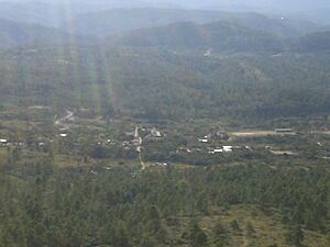
Belén has many pine forests. These forests surround the town and its nearby villages. Because of these trees, the local people enjoy nice, mild weather. This pleasant weather lasts almost all year. The only exception is the dry season. This season runs from February to June.
Besides pine trees, you can also find oak trees here. However, there are fewer oak trees than pine trees. The forests, along with the hills and mountains, create amazing views. These landscapes are inspiring for both locals and visitors.
Where Belén Is Located
Belén has clear boundaries with its neighbors.
- North: La Iguala and Gracias
- South: Intibucá Department
- East: Intibucá Department
- West: La Campa
- Total Area: Belén covers an area of 198 square kilometers.
What Belén Produces
The main crops grown in Belén are corn, beans, and coffee. These crops are very important for the local economy. The government also helps the people of Belén. They provide resources to improve everyone's well-being.
Organizations like World Vision also make a big difference. They help improve the quality of life for people who are struggling. Most of the main town and its villages have electricity. In 2007, the mayor's office started installing sewer systems. This was a big step for the main town of Belén.
Belén does not have any hotels or places to stay. This is because it is very close to the larger city of Gracias. Gracias has many hotels available for visitors.
People of Belén
In 2001, the population of Belén was 4,444 people. By 2008, it was estimated to be around 5,728 people.
- Villages: Belén has 5 villages.
- Settlements: There are 51 smaller settlements.
Who Lives in Belén
According to the 2013 census in Honduras, Belén municipality had 6,801 people. Most of the people living in Belén are Indigenous. About 90.78% of the population identifies as Indigenous. A large part of this group, 90.63%, are from the Lenca people. A smaller number of people are Mestizo (mixed heritage). There are also a few Black or Afro-Honduran people.
Visiting Belén
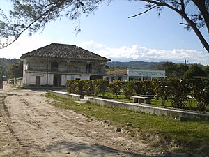
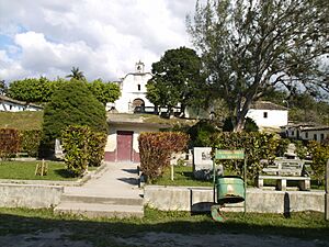
As you can see in the pictures, Belén has a typical old town layout. You can still find some old buildings made of adobe. Adobe is a type of sun-dried mud brick. Most of these old buildings are not kept up. However, the old colonial church is an exception. It is well-preserved.
As mentioned before, there are no hotels in Belén itself. But don't worry! The city of Gracias is very close by. Gracias has many hotels where visitors can stay.
- Local holidays: Belén celebrates "Virgen del Rosario" day. This holiday takes place every year on October 8.
See also
 In Spanish: Belén (Honduras) para niños
 | Chris Smalls |
 | Fred Hampton |
 | Ralph Abernathy |


