Ben Donich facts for kids
Quick facts for kids Ben Donich |
|
|---|---|
| Beinn Dòmhnaich | |

Ben Donich
|
|
| Highest point | |
| Elevation | 846 m (2,776 ft) |
| Prominence | c. 561 m |
| Listing | Corbett, Marilyn |
| Geography | |
| Location | Argyll and Bute, Scotland |
| Parent range | Arrochar Alps, Grampian Mountains |
| OS grid | NN218043 |
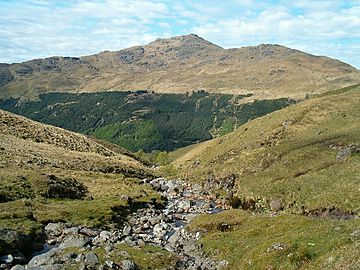
Ben Donich (also known as Beinn Dòmhnaich) is a cool mountain in the Arrochar Alps of Scotland. It's located close to Loch Goil in an area called Argyll and Bute. This mountain is part of the Ardgoil range, and it has a "sister" mountain nearby called The Brack. The closest village to Ben Donich is Lochgoilhead.
Contents
Ben Donich: A Scottish Mountain Adventure
Ben Donich stands tall at 847 metres (about 2,779 feet) high. This makes it the tallest mountain on the Ardgoil peninsula. It's a pretty big mountain, shaped a bit like a square pyramid. Its highest point, or summit, is right in the middle of four different ridges.
What Makes Ben Donich Special?
Ben Donich is known as a Corbett. A Corbett is a Scottish mountain that is between 2,500 and 3,000 feet high. It's also a Marilyn, which is a hill in the British Isles that rises at least 150 metres (about 492 feet) above the land around it. The mountain's slopes are mostly covered in grass, but you'll find some rocky parts on the steeper sections.
Reaching the Top
You can climb Ben Donich using any of its four ridges. However, getting to the lower parts can be a bit tricky. This is because the mountain is almost completely surrounded by thick forests.
One ridge goes down to an area called Gleann Mòr in the north-west. Another ridge heads south from the top, dropping into a wooded valley where the Donich Water river flows.
The most popular way to climb Ben Donich is along its south-east ridge. This path connects Ben Donich to The Brack. It crosses a spot called Bealach Dubh-lic, which is 384 metres high. From here, a walking path goes from Glen Croe all the way to Lochgoilhead. There's also a smaller ridge that goes north-east from the summit. This ridge looks over Glen Croe and a famous spot on the A83 road called "Rest and be Thankful."
The Summit View
The very top of Ben Donich is 847 metres high. At the summit, you'll find an Ordnance Survey trig point. This is a special marker used by mapmakers to help them create accurate maps of the area. It's a great spot to enjoy the views!
 | John T. Biggers |
 | Thomas Blackshear |
 | Mark Bradford |
 | Beverly Buchanan |

