Bennefield Branch (Leipsic River tributary) facts for kids
Quick facts for kids Bennefield Branch |
|
|---|---|
|
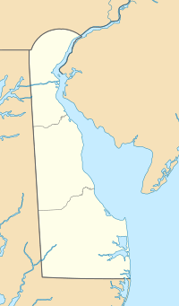
Location of Bennefield Branch mouth
|
|
| Other name(s) | Tributary to Leipsic River |
| Country | United States |
| State | Delaware |
| County | Kent |
| Physical characteristics | |
| Main source | Finis Branch divide about 0.5 miles west of Whitehall Crossroads, Delaware 20 ft (6.1 m) 39°16′08″N 075°32′03″W / 39.26889°N 75.53417°W |
| River mouth | Leipsic River about 0.5 miles northwest of Leipsic, Delaware 0 ft (0 m) 39°15′09″N 075°32′03″W / 39.25250°N 75.53417°W |
| Length | 1.40 mi (2.25 km) |
| Basin features | |
| Progression | south |
| River system | Leipsic River |
| Basin size | 1.29 square miles (3.3 km2) |
| Tributaries |
|
| Bridges | Big Woods Road |
Bennefield Branch is a small stream, about 1.40 miles (2.25 kilometers) long, located in Kent County, Delaware. It's like a small helper stream that flows into a bigger river called the Leipsic River. This type of small stream is sometimes called a "first-order tributary." This means it's one of the smallest streams that doesn't have any other streams flowing into it before it joins a larger river.
Contents
The River's Journey
Bennefield Branch starts its journey in an area near Whitehall Crossroads, Delaware. You could say it "rises" there, meaning that's where its waters first come together.
Where it Flows
From its starting point, Bennefield Branch flows generally towards the south. It travels for about 1.40 miles (2.25 kilometers).
Joining the Leipsic River
After its short journey, Bennefield Branch meets and joins the Leipsic River. This meeting point is located about 0.5 miles (0.8 kilometers) northwest of a town called Leipsic, Delaware.
Understanding the Watershed
A watershed is like a big bowl or area of land where all the rain and snowmelt drain into a specific stream, river, or lake. The Bennefield Branch has its own watershed.
Size of the Watershed
The Bennefield Branch watershed covers an area of about 1.29 square miles (3.34 square kilometers). This is all the land that contributes water to this small stream.
Rainfall in the Area
On average, the Bennefield Branch watershed receives about 45.1 inches (114.55 centimeters) of rain each year. This precipitation is what feeds the stream and keeps it flowing.
 | Sharif Bey |
 | Hale Woodruff |
 | Richmond Barthé |
 | Purvis Young |


