Leipsic River facts for kids
Quick facts for kids Leipsic River |
|
|---|---|

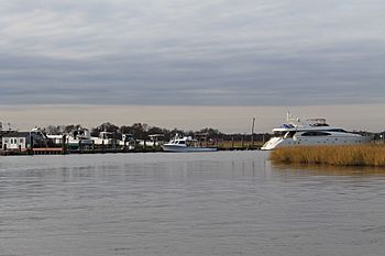
The Leipsic River at Leipsic
|
|
|
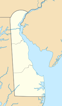
Location of Leipsic River mouth
|
|
| Other name(s) | Tributary to Delaware Bay |
| Country | United States |
| State | Delaware |
| County | Kent |
| Physical characteristics | |
| Main source | confluence of Pinks Branch and Taylor Branch about 1 mile north of Seven Hickories, Delaware 24 ft (7.3 m) 39°13′55″N 075°38′11″W / 39.23194°N 75.63639°W |
| River mouth | Delaware Bay about 0.25 miles south of Goose Point 0 ft (0 m) 39°14′40″N 075°24′11″W / 39.24444°N 75.40306°W |
| Length | 16.55 mi (26.63 km) |
| Basin features | |
| Progression | east |
| River system | Delaware Bay |
| Basin size | 53.13 square miles (137.6 km2) |
| Tributaries |
|
| Waterbodies | Masseys Millpond Garrisons Lake |
The Leipsic River is a river in the state of Delaware in the United States. It flows for about 16.7 miles (26.9 kilometers) through central Delaware. This river is an important part of the local environment.
Contents
About the Leipsic River
The Leipsic River starts in the northern part of Kent County, Delaware. This is about 8 miles (13 kilometers) northwest of the city of Dover, Delaware. The river begins where two smaller streams, called Pinks Branch and Taylor Branch, meet.
Where Does It Flow?
From its starting point, the Leipsic River generally flows towards the east. It passes by the small town of Leipsic, Delaware. After its journey, the river empties into the Delaware Bay. This meeting point is about 8 miles (13 kilometers) northeast of Dover.
River's Journey to the Bay
The area where the Leipsic River meets the Delaware Bay is very special. It is surrounded by large areas of wetlands. Wetlands are like soggy lands that are very important for nature. These specific wetlands are protected as part of the Bombay Hook National Wildlife Refuge. This refuge is a safe home for many different kinds of animals and plants.
What Feeds the River?
The Leipsic River gets its water from many smaller streams, also known as tributaries. These streams join the main river along its path. Some of the streams that flow into the Leipsic River include:
- Pinks Branch
- Taylor Branch
- Snows Branch
- Spruances Branch
- Bennefield Branch
- Willis Branch
- Alston Branch
- Dyke Branch
These smaller waterways help keep the Leipsic River flowing. They also contribute to the river's overall health and the ecosystem it supports.
 | Shirley Ann Jackson |
 | Garett Morgan |
 | J. Ernest Wilkins Jr. |
 | Elijah McCoy |


