Spruances Branch (Leipsic River tributary) facts for kids
Quick facts for kids Spruances Branch |
|
|---|---|
|
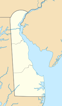
Location of Spruances Branch mouth
|
|
| Other name(s) | Tributary to Leipsic River |
| Country | United States |
| State | Delaware |
| County | Kent |
| Physical characteristics | |
| Main source | Finis Branch divide about 1 mile northwest of Whitehall Crossroads, Delaware 20 ft (6.1 m) 39°16′47″N 075°32′47″W / 39.27972°N 75.54639°W |
| River mouth | Leipsic River about 1 mile northwest of Leipsic, Delaware 0 ft (0 m) 39°15′05″N 075°32′42″W / 39.25139°N 75.54500°W |
| Length | 2.73 mi (4.39 km) |
| Basin features | |
| Progression | south |
| River system | Leipsic River |
| Basin size | 3.23 square miles (8.4 km2) |
| Tributaries |
|
| Bridges | Smyrna-Leipsic Road, Big Woods Road |
Spruances Branch is a small stream in Kent County, Delaware. It flows for about 2.73 mi (4.39 km). This stream is a "tributary," which means it's a smaller river or stream that flows into a larger one. Spruances Branch flows into the Leipsic River.
Where Does Spruances Branch Start and End?
Spruances Branch begins in an area about 1 mile (1.6 km) northwest of Whitehall Crossroads, Delaware. This starting point is near a "divide" with another stream called Finis Branch. A divide is like a high point of land that separates two different river systems.
From its start, Spruances Branch flows generally south. It travels through the landscape until it reaches the Leipsic River. The spot where it joins the Leipsic River is about 1 mile (1.6 km) northwest of the town of Leipsic.
What is a Watershed?
A watershed is an area of land where all the water that falls on it drains into a single river, stream, or lake. Think of it like a giant bowl where all the rain and snowmelt eventually flows to one main exit point.
Spruances Branch Watershed
The Spruances Branch watershed covers an area of about 3.23 square miles (8.4 km2). This means all the rain and water that falls on these 3.23 square miles eventually flows into Spruances Branch.
This area gets a good amount of rain each year, about 45.1 inches (114.5 cm). About 5% of the land in this watershed is covered by forests. Forests are important because they help keep the water clean and provide homes for wildlife.
 | Bessie Coleman |
 | Spann Watson |
 | Jill E. Brown |
 | Sherman W. White |


