Bernice, Oklahoma facts for kids
Quick facts for kids
Bernice, Oklahoma
|
|
|---|---|
| Motto(s):
"Crappie fishing capital of the world"
|
|

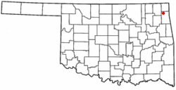
Location of Bernice, Oklahoma
|
|
| Country | United States |
| State | Oklahoma |
| County | Delaware |
| Area | |
| • Total | 1.41 sq mi (3.64 km2) |
| • Land | 0.82 sq mi (2.11 km2) |
| • Water | 0.59 sq mi (1.53 km2) |
| Elevation | 748 ft (228 m) |
| Population
(2020)
|
|
| • Total | 422 |
| • Density | 517.16/sq mi (199.77/km2) |
| Time zone | UTC-6 (Central (CST)) |
| • Summer (DST) | UTC-5 (CDT) |
| FIPS code | 40-05550 |
| GNIS feature ID | 2411679 |
Bernice is a small town in Delaware County, Oklahoma, United States. In 2010, about 562 people lived there. This was a bit more than the 504 people counted in 2000. Today, Bernice is mostly a place where people go for vacations or to retire. It is known as the "Crappie Fishing Capital of the World."
Contents
History of Bernice
How Bernice Started
Bernice was founded in 1912. Two partners, Rose Mode and Charles Lee, bought 60 acres of land. This land was in the Horse Creek Basin, in the northwest part of Delaware County. The town was named after Rose Mode's daughter, Bernice.
Early Growth and Challenges
A post office opened in Bernice on February 12, 1913. Soon, the town became an important place for farming in the area. By 1918, about 400 people lived in Bernice. The town had many businesses. These included a bank, a hat shop, a grain storage building, and a sawmill. There was also a hotel, a flour mill, and three general stores.
After World War I and during the Great Depression, the number of people living in Bernice went down. In 1920, there were 198 people. This dropped to 162 in 1930 and 91 in 1940. After World War II, the population started to grow again. By 1980, it reached 318 people.
Moving the Town
The original town of Bernice was in a low area. This area would flood when the Pensacola Dam was built. The dam created a large lake called Grand Lake o' the Cherokees. So, the people of Bernice moved their town to higher ground. This new location was outside the area that would be covered by the lake.
Bernice Today
Today, Bernice is a popular vacation spot. Many people from nearby communities visit the town. Indian Hills Resort is the oldest fun business in town. It started in 1940. Bernice State Park is also a big draw for visitors. It is about half a mile east of town, across the Neosho River.
Geography of Bernice
Bernice is located right next to Horse Creek. This creek is on the west side of the town.
Land and Water Area
The United States Census Bureau collects information about places. They say that Bernice covers about 1.5 square miles (3.9 square kilometers). About 0.9 square miles (2.3 square kilometers) of this is land. The other 0.6 square miles (1.6 square kilometers) is water. This means about 38.62% of the town's total area is water.
Population Changes
| Historical population | |||
|---|---|---|---|
| Census | Pop. | %± | |
| 1920 | 198 | — | |
| 1930 | 162 | −18.2% | |
| 1940 | 205 | 26.5% | |
| 1950 | 91 | −55.6% | |
| 1960 | 100 | 9.9% | |
| 1970 | 189 | 89.0% | |
| 1980 | 318 | 68.3% | |
| 1990 | 330 | 3.8% | |
| 2000 | 504 | 52.7% | |
| 2010 | 562 | 11.5% | |
| 2020 | 422 | −24.9% | |
| U.S. Decennial Census | |||
The census is a count of people. In 2000, there were 504 people living in Bernice. There were 245 homes. The average number of people in each home was about 2.06. The average age of people in Bernice was 51 years old.
Education in Bernice
Most children in Bernice go to Cleora Public School. A small part of the town, located to the north, is part of the Afton Public Schools district.
See also
In Spanish: Bernice (Oklahoma) para niños
 | Chris Smalls |
 | Fred Hampton |
 | Ralph Abernathy |

