Bethel, Missouri facts for kids
Quick facts for kids
Bethel, Missouri
|
|
|---|---|
|
Village
|
|

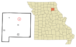
Location of Bethel, Missouri
|
|
| Country | United States |
| State | Missouri |
| County | Shelby |
| Area | |
| • Total | 0.14 sq mi (0.36 km2) |
| • Land | 0.14 sq mi (0.36 km2) |
| • Water | 0.00 sq mi (0.00 km2) |
| Elevation | 715 ft (218 m) |
| Population
(2020)
|
|
| • Total | 135 |
| • Density | 978.26/sq mi (377.82/km2) |
| Time zone | UTC-6 (Central (CST)) |
| • Summer (DST) | UTC-5 (CDT) |
| ZIP code |
63434
|
| Area code(s) | 660 |
| FIPS code | 29-05104 |
| GNIS feature ID | 0714027 |
Bethel is a small village in Shelby County, Missouri, in the United States. In 2020, about 135 people lived there. It is known for its unique history as a special community founded a long time ago.
Contents
History of Bethel
Bethel was started in 1844 by Dr. William Keil (1811–1877). He was a preacher from Prussia, which is now part of Germany. Dr. Keil and his followers believed in creating a "utopian colony." This means they tried to build a perfect society based on their religious beliefs.
Most of Dr. Keil's followers were German immigrants to America. They believed that Christians should share all their property and how they made things. So, they organized their colony this way. Men worked together on shared tasks. However, women's work, like cooking and cleaning, was still done in individual family homes.
By 1850, the Bethel Colony had about 500 people. By 1860, it grew to 600 people. The colony owned thousands of sheep, cattle, and horses. They also farmed over 3,500 acres of land. Bethel became an important trading center for the area.
Around 1855, Dr. Keil led some of his followers on a journey westward. They traveled along the Oregon Trail and eventually settled in Aurora, Oregon. There, they formed the Aurora Colony. More groups followed in later years.
The people who stayed in Bethel continued to share their property and work together. This lasted until 1880, three years after Dr. Keil passed away. In 1880, the shared property was divided among the remaining members. This brought an end to Missouri's most successful "communal experiment," where people lived and worked together, sharing everything.
Many of the buildings built by the Bethel Colony are still standing today. The Bethel Historic District was added to the National Register of Historic Places in 1970. This district includes the area bounded by Liberty, King, 1st, and 4th Streets. At least twenty of the original buildings are still there. Visitors can see these historic houses.
Other nearby places, Elim and Hebron, are also listed on the National Register of Historic Places.
Geography of Bethel
Bethel is located at 39°52′38″N 92°1′28″W / 39.87722°N 92.02444°W. This is its exact spot on a map.
According to the United States Census Bureau, the village covers a total area of about 0.14 square miles (0.36 square kilometers). All of this area is land, with no water.
People in Bethel
| Historical population | |||
|---|---|---|---|
| Census | Pop. | %± | |
| 1880 | 184 | — | |
| 1900 | 225 | — | |
| 1910 | 235 | 4.4% | |
| 1920 | 254 | 8.1% | |
| 1930 | 251 | −1.2% | |
| 1940 | 217 | −13.5% | |
| 1950 | 194 | −10.6% | |
| 1960 | 152 | −21.6% | |
| 1970 | 143 | −5.9% | |
| 1980 | 132 | −7.7% | |
| 1990 | 117 | −11.4% | |
| 2000 | 121 | 3.4% | |
| 2010 | 122 | 0.8% | |
| 2020 | 135 | 10.7% | |
| U.S. Decennial Census | |||
2010 Census Information
In 2010, there were 122 people living in Bethel. These people lived in 60 households, and 34 of these were families.
- About 25% of households had children under 18 living with them.
- About 43% were married couples living together.
- About 42% of all households were made up of single individuals.
- About 20% of households had someone living alone who was 65 years old or older.
The average age of people in the village was about 45.7 years old.
- About 21% of residents were under 18 years old.
- About 25% were 65 years old or older.
- The village had slightly more males (53.3%) than females (46.7%).
Notable Person
- Henry Theophilus Finck (1854-1926), a famous musical critic.
See also
 In Spanish: Bethel (Misuri) para niños
 | William Lucy |
 | Charles Hayes |
 | Cleveland Robinson |

