Bethel-Christian Avenue-Laurel Hill Historical District facts for kids
Quick facts for kids |
|
|
Bethel-Christian Avenue-Laurel Hill Historical District
|
|
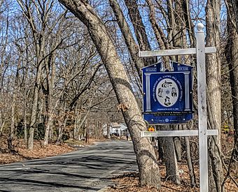
BCALHC sign Historic district
|
|
| Location | Christian Ave., Setauket-East Setauket, New York |
|---|---|
| Area | 7.5 acres (3.0 ha) |
| Built | 1848 |
| Architectural style | Classical Revival |
| NRHP reference No. | 100001808 |
| Added to NRHP | November 09, 2017 |
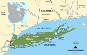
The Bethel-Christian Avenue-Laurel Hill Historical District is a special neighborhood in Setauket, Long Island, New York. In 2017, it was chosen to be protected as an important historical place.
This district has a long history, going back to the 1600s. It was a home for African Americans who had been enslaved and for Native Americans from the Setalcott tribe. Key parts of this historical area are the Bethel AME Church and the Laurel Hill Cemetery.
Contents
Early History of Setauket
In 1655, settlers from New England bought land from the Setalcott tribe. They began living peacefully in an area that stretched from Stony Brook to Port Jefferson.
During the American Revolutionary War, Setauket harbor was important. In August 1777, Colonel Samuel Blachley Webb and his soldiers crossed Long Island Sound. They landed near Setauket and marched to the town. The Battle of Setauket happened when they tried to attack the British. The soldiers could not get past the strong defenses around the Presbyterian church. They eventually left, taking some horses and quilts.
Laurel Hill Cemetery and Bethel AME Church
In 1815, a document shows that Isaac Satterly and Benjamin F. Thompson set aside land. This land along Christian Avenue in Setauket was to be a cemetery for people of color. This place is still known as Laurel Hill Cemetery. Since 1871, the Bethel AME Church has been in charge of it.
In 1848, land was given to the Bethel AME Church for its first building. This original church was destroyed by fire in 1871. The first Bethel AME Church was located on Christian Avenue in Stony Brook. Today, a line of stones shows where the church's foundation once stood.
The church moved to its current spot in 1871, and a new building was finished in 1874. That same year, the church's leaders also took control of Laurel Hill Cemetery. The new church building burned down in 1909 but was quickly rebuilt.
The Setalcott People
This historical district is one of the last places that truly shows the history of African-American and Native American people on Long Island. The Setalcott tribe lived in Setauket when Europeans first arrived. Their leaders, Warawakmy and Mahue, allowed the white settlers to use the land. Around 1670, these settlers brought enslaved Africans to the area.
Over time, people from the Setalcott tribe and African Americans married each other. Families like the Harts, Sells, Eato, Lewis, Edwards, Phillips, Scott, Green, Seaman, Young, and Tobias formed a mix of Native and African American cultures. Most of them worked as servants and laborers. This community was well-organized and stable. They were not allowed to live in other parts of the district. The church helped create a strong community separate from the white settlers.
The Bethel-Christian Avenue-Laurel Hill (BCALH) historic district was officially recognized in 2005. This was done to help protect the history and culture of the people still living there. The Christian Avenue community has a "distinct and indigenous way of life" that has lasted for centuries in Setauket.
In 2007, a community group formed to get more recognition for the area. With help from experts at Stony Brook University, they gathered important documents. Many homes in this mostly Native and African American district were not protected by any preservation laws. Setauket changed a lot in the late 1900s. Some homes were sold and torn down, causing the minority community to shrink.
Community members, school groups, and college students worked together on a project called "A Long Time Coming." Their goal was to help the BCALH district resist changes like rising taxes and new developments. These changes often push long-time residents out of their homes.
From 1867 to 1960, the community was known as Chicken Hill. This was a one-square-mile area on Christian Avenue, with the A.M.E. Church at its center. At one point, it was one of the most diverse communities on Long Island. It had Native Americans, African Americans, and immigrants from Eastern and Western Europe. A piano factory, which later became a rubber factory, provided many jobs. The Brookhaven Rubber Company employed many Irish and other European immigrants.
The Christian Avenue School was an important part of the community. Its original buildings were used for kindergarten and first grade. They closed in the late 1970s and were later replaced by new homes in the 1990s.
The BCALH historic district is special because it recognizes both the history and culture of this mixed Native and African American community. The district includes the Laurel Hill Cemetery, the church, an American Legion building, and 30 homes. The Setalcott tribe is not officially recognized by the Bureau of Indian Affairs. This is due to the number of remaining tribe members and how they identify themselves.
Rev David Eato House
The home of one of Bethel AME Church's first pastors is now on a list of endangered historic places. This list is kept by the Society for the Preservation of Long Island Antiquities. Richard Hawkins, a local resident, used to own the property. He helped African-American buyers get loans when it was difficult for them.
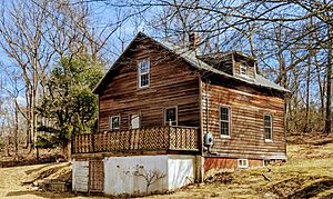
The Rev David Eato's House is in the BCALH District. It is currently owned by the Bethel African Methodist Episcopal Church. There are plans to restore it. Rev. Eato was one of the church's first pastors. He and his wife, Mary Baker, lived there until the 1930s. Mary was a freed slave from the South. She moved North and became an organist at a church in Port Washington. There, she met Eato. After they married, they moved to Setauket. Rev. Eato became one of the first ministers of Setauket's Bethel AME in the early 1900s. Mary was the superintendent of the Sunday school until the late 1930s.
The Hawkins Homestead
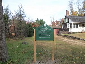
In 2013, the Three Village Community Trust bought the Hawkins Homestead. This home was added to the National Register of Historic Places in 1988. It is located on Christian Avenue in Setauket.
Patriots Rock
On the other side of Lake Street is the lower part of the Setauket Mill Pond. Main Street is on the opposite shore. About half a mile down Main Street is Patriots Rock. It is located at 108–114 Main Street, East Setauket, NY. This rock is part of the larger Old Setauket Historical District. A plaque on the rock remembers the spot where Colonel Webb fired his cannons during the Revolutionary War.
|


