Betsy Layne, Kentucky facts for kids
Quick facts for kids
Betsy Layne, Kentucky
|
|
|---|---|

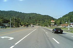
U.S. 23 in Betsy Layne
|
|
| Country | United States |
| State | Kentucky |
| County | Floyd |
| Settled | 1875 |
| Area | |
| • Total | 1.83 sq mi (4.75 km2) |
| • Land | 1.81 sq mi (4.68 km2) |
| • Water | 0.03 sq mi (0.07 km2) |
| Elevation | 879 ft (268 m) |
| Population
(2020)
|
|
| • Total | 651 |
| • Density | 360.07/sq mi (138.99/km2) |
| Time zone | UTC-5 (Eastern (EST)) |
| • Summer (DST) | UTC-4 (EDT) |
| ZIP code |
41605
|
| FIPS code | 21-06220 |
| GNIS feature ID | 2629576 |
Betsy Layne is a small community in Floyd County, Kentucky, United States. It is known as a census-designated place (CDP). This means it's a special area defined by the government for gathering information about its population. Betsy Layne was started in 1875. It is located along the Levisa Fork river.
About Betsy Layne
Betsy Layne is also known as a coal town. This means that in the past, its economy was largely based on coal mining. The community's post office first opened on May 1, 1908. Clayton S. Hitchins was the first postmaster. The ZIP code for Betsy Layne is 41605.
Location and Travel
Betsy Layne is found on the eastern edge of Floyd County. It shares a border with Pike County to the east. A major road, U.S. Route 23, goes right through the community. This road can take you about 13 miles (21 km) northwest to Prestonsburg. Or, you can travel about 12 miles (19 km) southeast to Pikeville.
Population and Nearby Communities
According to the 2020 census, Betsy Layne had a population of 651 people. The United States Census Bureau also groups Betsy Layne with a nearby community called Stanville. Together, they form what is called a Census County Division (CCD). This larger area had a population of 4,601 people in 2020. Other communities included in this CCD are Banner, Dana, Harold, Ivel, and Tram.
| Historical population | |||
|---|---|---|---|
| Census | Pop. | %± | |
| 2020 | 651 | — | |
| U.S. Decennial Census | |||
See also
 In Spanish: Betsy Layne (Kentucky) para niños
 | Percy Lavon Julian |
 | Katherine Johnson |
 | George Washington Carver |
 | Annie Easley |


