Big Bald Mountain facts for kids
Quick facts for kids Big Bald Mountain |
|
|---|---|

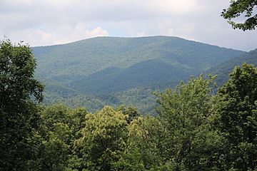
Big Bald Mountain, viewed from the Bear Rock Ridge Bed and Breakfast
|
|
| Highest point | |
| Elevation | 4,075 ft (1,242 m) |
| Prominence | 1,755 ft (535 m) |
| Listing | Highest point in Gilmer County |
| Geography | |
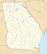
| Location | Gilmer County, Georgia, U.S. |
| Parent range | Blue Ridge Mountains |
| Topo map | USGS Blue Ridge, GA |
Big Bald Mountain is a tall mountain in Gilmer County, Georgia, in the United States. It is the highest point in Gilmer County. This mountain is part of the Rich Mountain Wilderness. This wilderness area is managed by the Chattahoochee National Forest.
Contents
Exploring Big Bald Mountain
Many mountains in this area have rich, dark soil. The trees here are mostly second-growth hardwood forests. This means the forests have grown back after older trees were cut down.
Where is Big Bald Mountain?
Big Bald Mountain is located in a beautiful part of Georgia. It is about 4.5 miles (7.2 kilometers) southwest of a town called Cherry Log. The mountain is also about 10 miles (16 kilometers) northeast of Ellijay. Another town, Blue Ridge, is about 8 miles (12.8 kilometers) north of the mountain.
Nearby, you'll find Rich Mountain, which is about 1.4 miles (2.2 kilometers) southwest. A main road, U.S. Route 76, runs to the west of Big Bald Mountain. The very top of Big Bald Mountain is inside the Rich Mountain Wildlife Management Area. This area helps protect local wildlife.
How Tall is Big Bald Mountain?
Big Bald Mountain stands at 4,075 feet (1,242 meters) high. This makes it the tallest mountain in Gilmer County. It is also one of the tallest mountains in the entire state of Georgia. It ranks as the 19th tallest mountain in Georgia. This ranking uses a special rule called the "160 feet prominence rule." This rule helps measure how much a mountain stands out from the land around it.
Hiking Big Bald Mountain
There are no official hiking trails that go right over the top of Big Bald Mountain. However, adventurous hikers can still reach the summit. They can hike off-trail from Rich Mountain Road. This road used to be a logging road, which means it was used for cutting down and moving trees. Now, it runs through the Rich Mountains, offering a way to explore the area.
 | Delilah Pierce |
 | Gordon Parks |
 | Augusta Savage |
 | Charles Ethan Porter |


