Bill Williams Mountain facts for kids
Quick facts for kids Bill Williams Mountain |
|
|---|---|
| Highest point | |
| Elevation | 9,259 ft (2,822 m) NAVD 88 |
| Prominence | 2,296 ft (700 m) |
| Geography | |
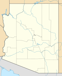
| Location | Coconino County, Arizona, U.S. |
| Topo map | USGS Williams South |
| Climbing | |
| Easiest route | Road and short hike |
Bill Williams Mountain is a tall mountain peak in Arizona, U.S. It stands about 31 miles (50 km) west of Flagstaff. You can find it about 3.5 miles (5.6 km) south of the town of Williams, Arizona. This mountain is part of the huge Kaibab National Forest.
Contents
What is Bill Williams Mountain?
Bill Williams Mountain is a big mountain that reaches 9,259 feet (2,822 meters) high. It's a well-known spot in Coconino County, Arizona. The mountain is a fun place for outdoor activities.
Why is it called Bill Williams Mountain?
The mountain got its name from a famous person. He was called Old Bill Williams. He lived in the 1800s. Old Bill Williams was a scout, a guide, and a mountain man. He explored a lot of the American West.
Part of a Volcanic Field
Bill Williams Mountain is part of something called the San Francisco volcanic field. This area has many volcanoes. But don't worry, these volcanoes are not active anymore. They are part of Arizona's interesting geological history.
Exploring the Mountain
You can reach the top of Bill Williams Mountain. There is a road that goes up part of the way. After that, it's a short hike to the very top. This makes it easier for many people to visit.
Location and Surroundings
The mountain is located in Coconino County, Arizona. This county is known for its beautiful natural areas. The mountain is also inside the Kaibab National Forest. This forest is a large protected area. It is home to many plants and animals.
Categories
 | May Edward Chinn |
 | Rebecca Cole |
 | Alexa Canady |
 | Dorothy Lavinia Brown |


