
Bird's-eye view facts for kids

A bird's-eye view is a way of looking at something from high up. It's like seeing the world as a bird would from the sky. This view shows objects or places from a very steep angle, looking downwards.
Bird's-eye views can be real photos taken from the air. They can also be drawings or paintings. People often use them when making blueprints, floor plans, and maps.
Long ago, before airplanes were invented, people used the term "bird's eye" for views drawn from high places. These places could be a mountain or a tall tower. Sometimes, artists would imagine what a bird would see. These views became very popular in the late 1800s in the United States and Europe.
Contents
What is a Bird's-Eye View?
The terms aerial view and aerial viewpoint are sometimes used to mean the same thing as a bird's-eye view. An aerial view can be any view from a great height. This includes looking sideways from an airplane window.
An overhead view is very similar to a bird's-eye view. However, it usually means looking down from a slightly lower height. For example, in video games, an "overhead view" might be just a few feet above a character. You can learn more about this at top-down perspective.
Today, it's easier to see satellite images. Microsoft Bing Maps offers satellite photos of the whole planet. It also has a special "Bird's eye view" feature in some places. These photos are taken at a 40-degree angle, not straight down. Satellite programs let you "fly over" and see the world from this special angle.
Bird's-Eye Shots in Movies and Sports
In filmmaking and video production, a bird's-eye shot means the camera looks straight down at the subject. This makes things look shorter and wider than they are.
Filmmakers use this shot for a few reasons. It can show a whole scene from above. It can also make subjects look small or unimportant. To get this shot, the camera is lifted high up. If a very large area needs to be filmed, a crane shot is used.
Bird's-eye views are also common in broadcasting of sports events. This is especially true in the 21st century. Cameras like the Skycam, CableCam, and Spidercam are often used to get these high-up views.
Gallery
-
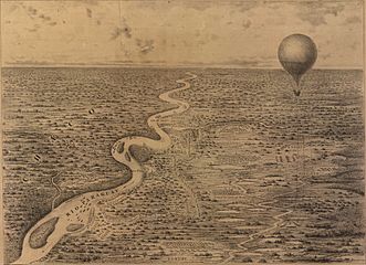
This bird's-eye view shows military operations during the Paraguayan War in 1868. It was seen from James Allen's observation balloon.
-
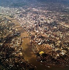
An aerial view of the City of London from 2011.
-
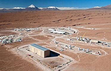
Flying above the ESO's Atacama Large Millimeter Array site.
-
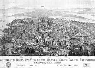
A bird's-eye view drawing of the Alaska–Yukon–Pacific Exposition from 1909.
-
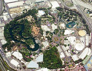
An aerial view of Disneyland in 2004.
-
This is a painting of Amsterdam Airport Schiphol by Janneke Viegers, a Dutch artist.
-
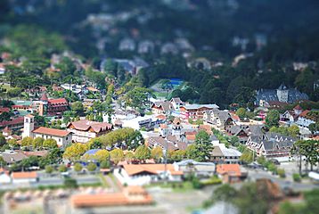
A bird's-eye view of Campos do Jordão, Brazil. This picture uses a special "tilt shift" lens effect.


_(2).jpg)
Bird's-Flight View

Sometimes, people talk about a bird's-flight view as different from a bird's-eye view. A bird's-eye view shows a scene as it would truly look from one high spot. Things farther away would look smaller, just like in a photo.
A bird's-flight view is a bit different. It combines a flat map of the ground with drawings of buildings. All the buildings are shown at about the same size, no matter how far away they are. It's like seeing the landscape from a balloon that's high enough to make everything look clear, but not so high that things get blurry. This way of drawing maps was popular with mapmakers in the 1500s and early 1600s.
See also
 In Spanish: Vista aérea para niños
- Aerial landscape art
- Aerial perspective (disambiguation)
- Aerial photography
- Archimedean point
- Camera angle
- Cinematic techniques
- Filmmaking
- Google Earth
- Pictorial map
- Pictometry
- Plans (drawings)
- Top-down perspective
- Video production
- Worm's-eye view
