Google Earth facts for kids
|
Screenshot
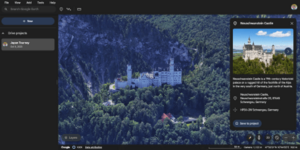
Google Earth 10 on Google Chrome
|
|||||||||
| Original author(s) | Keyhole, Inc. | ||||||||
|---|---|---|---|---|---|---|---|---|---|
| Developer(s) | |||||||||
| Initial release | June 10, 2001 | ||||||||
| Stable release(s) [±] | |||||||||
|
|||||||||
| Preview release(s) [±] | |||||||||
| Written in | C++, Dart | ||||||||
| Operating system | |||||||||
| Available in | Various languages | ||||||||
| Type | Virtual globe | ||||||||
| License | Freeware | ||||||||
Google Earth is a cool computer program and website made by Google. It shows you a 3D picture of our Earth. It uses mostly satellite imagery to create this amazing view. The program works by putting satellite pictures, photos from planes, and other map data onto a 3D globe. This lets you see cities and landscapes from all sorts of angles.
You can explore the globe by typing in addresses or special codes. You can also use your keyboard or mouse to move around. Google Earth is also available on smartphones and tablets. On these devices, you can use your touch screen or a stylus to navigate. People can even add their own information to Google Earth using a special language called Keyhole Markup Language. They can then share this data through websites or blogs. Google Earth can show many different kinds of images on the Earth's surface. In 2019, Google shared that Google Earth covers more than 97 percent of the world!
Besides exploring Earth, Google Earth has other neat tools. The desktop version lets you measure distances. You can also explore other planets like the Moon and Mars, and even view the night sky. There's even a flight simulator game built in! Other features let you see photos from different places, information from Wikipedia about certain spots, and Street View images. The web version of Google Earth also has a "Voyager" feature. This adds special tours inside the program, often led by scientists and people who make documentaries.
Some people have worried that Google Earth might affect privacy or national security. Because of this, the program has been blocked in some countries. Some nations have asked Google to hide certain areas in its satellite images, especially places with military buildings.
Contents
How Google Earth Started
The main idea behind Google Earth came from a company called Intrinsic Graphics in the late 1990s. They were making software for 3D games. To show off their 3D software, they created a spinning globe that you could zoom into. It was like the Powers of Ten movie. People really liked this demo.
However, Intrinsic's leaders wanted to focus on games. So, in 1999, they created a new company called Keyhole, Inc. Keyhole found a way to send huge amounts of map data over the internet to their software. This was a very important part of the technology. They also bought map data from governments and other places. Their product, "Keyhole EarthViewer," was sold on CDs. It was used in areas like real estate, urban planning, and for defense and intelligence. Users paid a yearly fee for the service.
Things changed for Keyhole in early 2003 during the 2003 invasion of Iraq. Keyhole convinced news channels like CNN and ABC to use their cool 3D images. This helped them show what was happening in Baghdad to viewers. In return, the news channels mentioned Keyhole on air. During the invasion, many reporters used it a lot. This let CNN and millions of viewers follow the war in a new way. Public interest in the software grew very quickly. Keyhole's computers couldn't keep up with all the demand.
Soon, Keyhole was contacted by the Central Intelligence Agency's investment company, In-Q-Tel. They also heard from the National Geospatial-Intelligence Agency. These groups wanted to use Keyhole's technology for defense maps. This gave Keyhole the money it really needed. In October 2004, Google bought Keyhole. Google realized that over 25% of its searches were for maps and directions. Keyhole's Earth Viewer became the base for Google Earth, which launched in 2005. Other parts of Keyhole's technology were used in Google Maps.
In 2021, Google updated its "layers" feature in Google Earth. This change combined some layers but also removed others.
How Google Earth Shows Images
Google Earth shows images on a digital globe. It starts with a single big picture of the planet from far away. As you zoom in, the images change to more detailed ones of the same area. The date and time these images were taken can be different for various places. These images come from satellites or aircraft.
Before NASA and the USGS launched the Landsat 8 satellite, Google used images from Landsat 7. Landsat 7 had a problem that left diagonal gaps in its pictures. In 2013, Google used a special method to fix this. They combined many images from Landsat 7 to get rid of clouds and gaps. This created one big "mosaic" image of the whole planet. Since then, Google has used many sources to get better and more frequent images. The images are stored on Google's computers. Google Earth needs an internet connection to get these images when you open the program.
The detail of the images ranges from about 0.15 to 15 meters (about 0.5 to 50 feet). The ocean floor images are less detailed, from 100 to 1000 meters (about 330 to 3300 feet). For most of Earth, Google Earth uses elevation data from NASA's Shuttle Radar Topography Mission. This makes the flat images look 3D, even if they are actually 2D.
Google says that every image made from Google Earth using its satellite data is a copyrighted map. Google lets people use these images for personal, non-commercial things. For example, you can use them on your personal website or blog. You just need to keep the copyright and say where the images came from.
See How Places Change Over Time
In version 5.0, Google added a "Historical Imagery" feature. This lets you see older images of a place. If you click the clock icon, a time slider appears. This slider shows you when past images are available. This feature is great for seeing how an area has changed over many years. You can even watch a zoomable video of changes over as many as 38 years!
3D Buildings and Places
Google Earth shows 3D building models in some cities. These include very realistic 3D images made using a technique called photogrammetry. At first, 3D buildings were made by users with programs like SketchUp. In 2009, Google also launched Building Maker. Users would then upload these models to Google Earth.
In June 2012, Google announced they would start replacing user-made 3D buildings with automatically generated 3D models. This change happened gradually, starting with bigger cities. The goal was to make all 3D buildings look more consistent. By early 2016, 3D imagery was available in hundreds of cities in over 40 countries. This included every U.S. state and all continents except Antarctica.
In 2009, Google worked with the Museo del Prado museum in Madrid. The museum chose 14 of its paintings to be photographed in super high detail (14,000 megapixels). You can see these paintings inside the 3D version of the Prado in Google Earth and Google Maps.
Street View Exploration
On April 15, 2008, Google added Street View to Google Earth. Street View shows 360-degree panoramic photos taken at street level in certain cities. These photos are taken by cameras on cars. You can view them at different sizes and angles. You can also move around using arrow icons on the screen.
Using Street View in Google Earth, you can visit and explore 30 World Heritage Sites from UNESCO. These sites come with historical information and markers. Some examples include the Great Pyramid, the Taj Mahal, Sagrada Família, and the Great Sphinx.
In 2019, Walt Disney World and Pixar worked with Google to create "Pixar Street View." This allowed people to search for hidden Pixar "Easter eggs" inside Toy Story Land at Disney's Hollywood Studios using Street View.
Exploring Water and Oceans
Google Ocean was added to Google Earth 5.0 in 2009. This feature lets you zoom below the ocean's surface. You can see the 3D shape of the ocean floor. It includes information from over 20 layers of content, provided by leading scientists and oceanographers. On April 14, 2009, Google also added depth data for the Great Lakes.
In June 2011, Google made some deep ocean floor areas much clearer. The resolution improved from 1-kilometer grids to 100 meters. This sharper view is available for about 5 percent of the oceans.
Beyond Earth: Space Exploration
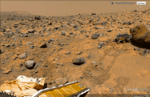
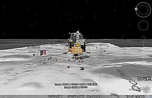
Google has special programs and features, including within Google Earth, that let you explore Mars, the Moon, and the view of the sky from Earth. You can also see outer space and the surfaces of different objects in our Solar System.
Google Sky
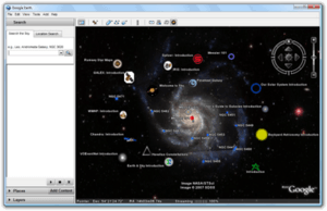
Google Sky was added to Google Earth 4.2 on August 22, 2007. It also became a website application on March 13, 2008, and later came to Android smartphones with augmented reality features. Google Sky lets you see stars and other things in space. Google created it by working with the Space Telescope Science Institute (STScI). They planned to add public images from 2007 and color images from the Hubble Space Telescope's archives. New Hubble pictures were added to Google Sky as soon as they were released.
Google Sky also shows constellations, stars, galaxies, and animations of planets moving in their orbits.
Google Mars
Google Mars is a special part of Google Earth that shows images of the planet Mars. Google also has a website version, but the maps are much clearer within Google Earth. They include 3D terrain, infrared images, and elevation data. There are also very high-resolution images from the Mars Reconnaissance Orbiter's HiRISE camera. These are as detailed as city images on Earth. You can also see many high-resolution panoramic images from Mars landers, like the Mars Exploration Rovers, Spirit and Opportunity. You can view these like Google Street View.
Mars also has a small fun application near the face on Mars. It's a robot character named Meliza that you can talk with.
Google Moon
Google Moon started as a website application. Google added it to Google Earth for the 40th anniversary of the Apollo 11 mission on July 20, 2009. Google and Buzz Aldrin showed it to guests at the Newseum in Washington, D.C.. Google Moon includes several tours, like one for the Apollo missions. It has maps, videos, and Street View-style panoramas, all provided by NASA.
Other Cool Features
Google Earth has many features called "layers" that help you learn about specific places. These layers can include photos and videos. Some layers even offer tours that guide you through different places in a set order. You can also create your own custom layers using KML. You can mark locations with "placemarks" and put them into folders. For example, you could list interesting landmarks around the world. Then, you can add descriptions with photos and videos. Others can see these by clicking on your placemarks when viewing your new layer.
In December 2006, Google Earth added connections with Wikipedia and Panoramio. For the Wikipedia layer, information is taken from Wikipedia articles that have location coordinates. The Panoramio layer shows pictures uploaded by Panoramio users, placed on the map based on where the user said they were taken. Google Earth also has a layer for user-submitted panoramic photos, which you can explore like Street View.
Google Earth also helps you keep up with current events. In 2007, Google started letting users see real-time traffic data from Google Traffic. This information comes from crowdsourced data, like the GPS locations of cell phone users.
Flight Simulators
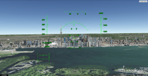
In Google Earth 4.2, a flight simulator was added. It was a hidden feature at first in 2007. But starting with version 4.3, it got its own option in the menu. You can control the simulator with your keyboard, a mouse, or a joystick. The simulator also has animations, so things like planes move realistically.
Another flight simulator, GeoFS, used to work inside a web browser using the Google Earth Plug-in. Since September 1, 2015, it uses a different open-source program called CesiumJS.
Liquid Galaxy
Liquid Galaxy is a setup of many computers running Google Earth. It creates a super immersive experience. On September 30, 2010, Google shared how to build these systems. Liquid Galaxy has also been used to view panoramic photos and Google Street View.
Different Versions of Google Earth
Google Earth has been released for many different devices and operating systems. These include macOS, Linux, iOS, and Android. The Linux version started as a beta in version 4. Google Earth was released for Android on February 22, 2010, and for iOS on October 27, 2008. The mobile versions let you use multi-touch screens to move, zoom, or spin the globe. They also let you select your current location. An automotive version of Google Earth was available in the 2010 Audi A8 car. On February 27, 2020, Google made its web-based version of Earth work on other browsers like Firefox, Edge, and Opera.
| Version | Release date | Changes |
|---|---|---|
| 1.0 | June 10, 2001 | |
| 1.4 | January 2002 | |
| 1.6 | February 2003 | |
| 1.7.2 | October 2003 | |
| 2.2 | August 2004 |
|
| 3.0 | June 2005 |
|
| 4.0 | June 2006 | |
| 4.1 | May 2007 | |
| 4.2 | August 2007 |
|
| 4.3 | April 2008 |
|
| 5.0 | May 2009 |
|
| 5.1 | November 2009 | |
| 5.2 | July 2010 |
|
| 6.0 | March 2011 |
|
| 6.1 | October 2011 | |
| 6.2 | April 2012 |
|
| 7.0 | December 2012 |
|
| 7.1 | April 2013 |
|
| 7.3 | July 2017 |
|
| 8.0 | October 2014 |
|
| 9.0 | April 2017 |
|
| 10.0 | September 2023 |
|
Google Earth Pro
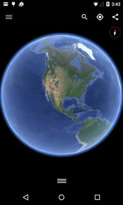
Google Earth Pro was originally a more advanced version for businesses. It had features like a movie maker and a data importer. Until January 2015, it cost $399 per year. Then, Google decided to make it free for everyone! Google Earth Pro is now the standard desktop version of Google Earth (since version 7.3). The Pro version includes extra software for making movies, better printing, and exact measurements. It works on Windows, macOS, and Linux computers.
Google Earth Enterprise
Google Earth Enterprise was made for organizations and businesses. It let them use Google Earth's features with their own company data. Google stopped supporting Google Earth Enterprise on March 20, 2015. It allowed developers to create maps and 3D globes for private use. The source code for parts of Google Earth Enterprise was released for free in March 2017.
Google Earth Studio
Google Earth Studio is a web-based version of Google Earth. It's used to create animations using Google Earth's 3D images. As of June 2021, it was still in a special preview mode and required signing up to use it. It has features for creating animations frame by frame, quick-start projects, and exporting 3D camera movements.
Google Earth 9
Google Earth 9 was first released on April 18, 2017, after being developed for two years. The main new thing was a new web version of Google Earth. This version added the "Voyager" feature. With Voyager, users could see a special page with guided tours led by scientists and people who make documentaries. This version also added an "I'm Feeling Lucky" button, which looks like a dice. If you click it, it takes you to a random place on Earth and shows you a "Knowledge Card" with a short piece of information from Wikipedia about that place.
Google Earth VR
On November 16, 2016, Google released a virtual reality version of Google Earth for Valve's Steam gaming platform. Google Earth VR lets you move around using VR controllers. It works with Oculus Rift and HTC Vive virtual reality headsets. On September 14, 2017, Google Earth VR added Street View support in its 1.4 update.
Google Earth Outreach
Google Earth Outreach is a special program where Google helps and gives money to different non-profit organizations. Starting in 2007, these donations often come with special layers in Google Earth. This lets users see a non-profit's projects and goals by going to related locations on the map. Google Earth Outreach also offers online training. This teaches people how to use Google Earth and Google Maps to educate the public about issues affecting local areas or the whole world. In June 2008, they trained 20 native tribes in the Amazon rainforest, like the Suruí. This helped them protect their culture and raise awareness about deforestation.
Some non-profit organizations featured in Google Earth through the Outreach program include Arkive, the Global Heritage Fund, WaterAid, and the World Wide Fund for Nature.
Google Earth Engine
Google Earth Engine is a powerful cloud computing platform. It helps process satellite imagery and other data about Earth. It gives access to a huge collection of satellite images and the computing power needed to analyze them. Google Earth Engine lets you see how things like farming, natural resources, and climate change over time. It uses data from the Landsat satellite program, which flies over the same places on Earth every sixteen days. Google Earth Engine makes Landsat and Sentinel-2 data easy for researchers to use.
The platform has a data catalog and computers for analysis. This helps scientists work together using data, algorithms, and visualizations. It also provides ways for programmers to make requests to the servers. There's also a visual tool for developing applications.
An early version of Earth Engine was shown in 2009 at COP15. Earth Engine officially launched in 2010 at COP16. It came with maps of water in the Congo Basin and forests in Mexico.
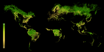
In 2013, researchers from University of Maryland used Earth Engine to create the first detailed global maps of forest cover and loss. They reported an overall loss of forests worldwide. Since then, Earth Engine has been used in hundreds of scientific articles. These cover many areas like forestry, agriculture, water quality, natural disasters, city mapping, and climate science.
Earth Engine has been free for school and research use since it launched. Commercial use was not allowed until 2021. Then, Google announced a preview of Earth Engine as a commercial cloud service. Early users included Unilever, USDA, and Climate Engine.
See also
 In Spanish: Google Earth para niños
- Elevation
- Esri, makers of ArcGIS Earth
- Flyover (Apple Maps), a similar 3D feature on Apple Maps
- List of space flight simulation games
- Planetarium software
- List of observatory software
- Orthophotomap, a type of aerial and satellite image in Google Earth
- Virtual globe, the type of software Google Earth is
- Web mapping
 | Dorothy Vaughan |
 | Charles Henry Turner |
 | Hildrus Poindexter |
 | Henry Cecil McBay |


