Google Street View facts for kids
Google Street View is a cool feature found in Google Maps and Google Earth. It lets you explore streets and places around the world right from your computer or phone! Imagine being able to "walk" down a street in Paris or see a famous landmark in Japan, all without leaving your home.
Google Street View started on May 25, 2007. It began in a few cities in the United States. Since then, it has grown a lot. Today, it covers many countries and territories across the globe. You can find pictures of busy city areas, quiet neighborhoods, and even some amazing natural spots.
Contents
How Google Street View Works
Taking Pictures
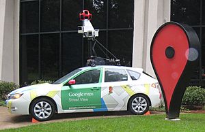
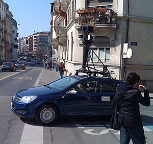
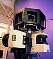
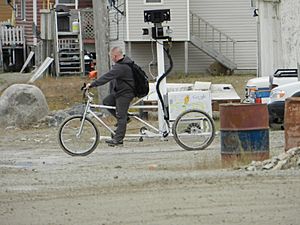
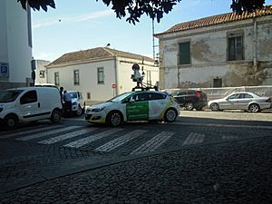
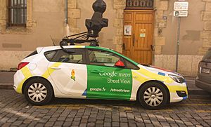
Google uses special cars, bikes, and even backpacks to take pictures for Street View. These vehicles have cameras on top that capture 360-degree photos. This means they take pictures in every direction around them.
The cars drive along streets, taking photos as they go. For places cars can't reach, like parks or narrow paths, Google uses trikes (three-wheeled bikes) or even backpacks with cameras. These backpacks are called "Trekker" cameras. They let people walk through places like hiking trails or inside museums to capture images.
What You See
When you use Google Street View, you see a series of connected photos. You can click arrows to move forward or backward along a street. You can also drag your mouse to look around in any direction. It feels like you are actually there!
Google tries to keep the images updated. This means they send out their cars and trekkers regularly to take new photos. This way, you can see how places might have changed over time.
Where You Can Explore
Google Street View is available in many countries. It started in the United States and quickly spread to other places. Now, you can explore streets in countries like Canada, Mexico, most of Europe, Australia, Japan, and many more.
Some countries have full coverage, meaning most of their public streets are mapped. Other countries might have partial coverage, with only major cities or landmarks available. Google is always working to add more places. They even have plans to expand to new areas in the future.
You can find Street View in places like:
- North America: United States, Canada, Mexico
- South America: Brazil, Argentina, Chile
- Europe: France, Germany, Italy, Spain, United Kingdom
- Asia: Japan, South Korea, Taiwan, Singapore
- Australia and Oceania: Australia, New Zealand
- Africa: South Africa, Botswana
This amazing tool lets you see famous places, plan trips, or just explore new areas from your home. It's like having a virtual tour guide to the world!
Images for kids
See also
 In Spanish: Google Street View para niños
 | Roy Wilkins |
 | John Lewis |
 | Linda Carol Brown |


