Blaine, Kentucky facts for kids
Quick facts for kids
Blaine, Kentucky
|
|
|---|---|

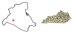
Location in Lawrence County, Kentucky
|
|
| Country | United States |
| State | Kentucky |
| County | Lawrence |
| Incorporated | March 10, 1886 |
| Government | |
| • Type | City Commission |
| Area | |
| • Total | 0.28 sq mi (0.74 km2) |
| • Land | 0.28 sq mi (0.73 km2) |
| • Water | 0.00 sq mi (0.00 km2) |
| Elevation | 646 ft (197 m) |
| Population
(2020)
|
|
| • Total | 66 |
| • Density | 233.22/sq mi (90.00/km2) |
| Time zone | UTC-5 (Eastern (EST)) |
| • Summer (DST) | UTC-4 (EDT) |
| ZIP code |
41124
|
| Area code(s) | 606 |
| FIPS code | 21-07264 |
| GNIS feature ID | 2403873 |
Blaine is a small city located in Lawrence County, Kentucky, in the United States. It is known as a "home rule-class city," which means it has some power to govern itself. According to the 2020 census, 66 people live there. In the 2010 census, the population was 47.
Contents
History of Blaine
Blaine was first settled around the year 1800. By 1882, it had become a local center for trade. The city's post office has been open since at least May 10, 1828.
City's Name and Incorporation
The city was officially named "Blaine" and became an incorporated city on March 10, 1886. However, during the rest of the 1800s, people also called it "Blainetown" or "Mouth of Hood."
Recent Leadership
In the city election held in 2016, Brad Mattingly was chosen as the mayor of Blaine.
Geography of Blaine
Blaine is found in the western part of Lawrence County. It sits in the valley of Blaine Creek. This creek flows northeast and eventually joins the Big Sandy River. Hood Creek also meets Blaine Creek from the south in Blaine.
Roads and Travel
Two main roads pass through Blaine. Kentucky Route 32 goes through the city. If you travel east on KY 32, you will reach Louisa about 18 miles away. If you go west, you will arrive at Sandy Hook, which is about 20 miles from Blaine.
Kentucky Route 201 also goes through the center of Blaine with KY 32. KY 201 leads north about 13 miles to Webbville. Going south on KY 201 will take you about 18 miles to Staffordsville.
Land and Water Area
The United States Census Bureau reports that the total area of Blaine is about 0.28 square miles (0.74 square kilometers). A very small part of this area, about 0.24%, is water.
Population Information
In the year 2000, there were 245 people living in Blaine. These people lived in 95 households, and 74 of these were families.
Population Changes Over Time
The population of Blaine has changed quite a bit over the years. Here's a look at how many people lived in Blaine during different census years:
| Historical population | |||
|---|---|---|---|
| Census | Pop. | %± | |
| 1900 | 134 | — | |
| 1910 | 136 | 1.5% | |
| 1920 | 103 | −24.3% | |
| 1930 | 144 | 39.8% | |
| 1940 | 124 | −13.9% | |
| 1970 | 168 | — | |
| 1980 | 358 | 113.1% | |
| 1990 | 271 | −24.3% | |
| 2000 | 245 | −9.6% | |
| 2010 | 47 | −80.8% | |
| 2020 | 66 | 40.4% | |
| U.S. Decennial Census | |||
Age Groups
In 2000, about 25.3% of the people in Blaine were under 18 years old. About 13.9% were 65 years old or older. The average age of people in Blaine was 33 years.
Education in Blaine
Students who live in Blaine typically attend schools within the local area.
Local Schools
- Blaine Elementary School
- Lawrence County High School
Climate in Blaine
Blaine experiences a type of weather known as a Humid subtropical climate. This means the area has fairly high temperatures and rain spread out evenly throughout the year. On climate maps, this is often shown as "Cfa."
| Climate data for Blaine, Kentucky | |||||||||||||
|---|---|---|---|---|---|---|---|---|---|---|---|---|---|
| Month | Jan | Feb | Mar | Apr | May | Jun | Jul | Aug | Sep | Oct | Nov | Dec | Year |
| Mean daily maximum °C (°F) | 6 (42) |
8 (46) |
13 (56) |
21 (69) |
25 (77) |
28 (83) |
30 (86) |
30 (86) |
27 (80) |
21 (70) |
14 (57) |
8 (47) |
19 (67) |
| Mean daily minimum °C (°F) | −8 (18) |
−7 (20) |
−2 (28) |
3 (37) |
8 (47) |
13 (56) |
16 (61) |
16 (60) |
12 (53) |
4 (39) |
−1 (30) |
−5 (23) |
4 (39) |
| Average precipitation mm (inches) | 86 (3.4) |
74 (2.9) |
100 (4) |
100 (4) |
110 (4.2) |
89 (3.5) |
130 (5.3) |
79 (3.1) |
89 (3.5) |
64 (2.5) |
79 (3.1) |
91 (3.6) |
1,100 (43) |
| Source: Weatherbase | |||||||||||||
See also
 In Spanish: Blaine (Kentucky) para niños

