
Blandford (CDP), Massachusetts facts for kids
Quick facts for kids
Blandford, Massachusetts
|
|
|---|---|

Blandford Country Store
|
|
_highlighted.svg)
Location in Hampden County in Massachusetts
|
|
| Country | United States |
| State | Massachusetts |
| County | Hampden |
| Town | Blandford |
| Area | |
| • Total | 1.15 sq mi (2.98 km2) |
| • Land | 1.15 sq mi (2.98 km2) |
| • Water | 0.00 sq mi (0.01 km2) |
| Elevation | 1,451.4 ft (442.4 m) |
| Population
(2020)
|
|
| • Total | 363 |
| • Density | 315.65/sq mi (121.84/km2) |
| Time zone | UTC-5 (Eastern (EST)) |
| • Summer (DST) | UTC-4 (EDT) |
| ZIP code |
01008
|
| Area code(s) | 413 |
| FIPS code | 25-06050 |
| GNIS feature ID | 0608279 |
Blandford is a small community in Hampden County, Massachusetts, United States. It is known as a census-designated place (CDP). This means it is a part of the larger town of Blandford that has a lot of people living close together.
In 2020, about 363 people lived in Blandford CDP. The entire town of Blandford had more people. Blandford is also part of the Springfield Metropolitan Statistical Area. This is a group of cities and towns that are connected by jobs and daily life.
Contents
Exploring Blandford's Location
Blandford CDP is located in the eastern-central part of the town of Blandford. You can find it where Massachusetts Route 23 meets North Street. The community stretches out about half a mile in different directions from its center. It also goes about 1.5 miles east along Route 23.
Highways and Hills
Interstate 90, also called the Massachusetts Turnpike, runs along the edge of Blandford. However, there is no direct exit to the community from this highway. Blandford sits at an elevation of about 1,451 feet (442.4 meters). It is located on the eastern side of the Berkshires, which are a range of hills and mountains.
Land Area
According to the United States Census Bureau, Blandford CDP covers a total area of about 1.15 square miles (3.0 square kilometers). All of this area is land.
Who Lives in Blandford?
The number of people living in Blandford CDP changes over time.
| Historical population | |||
|---|---|---|---|
| Census | Pop. | %± | |
| 2020 | 363 | — | |
| U.S. Decennial Census | |||
In 2020, the population was 363 people. This information comes from the official U.S. Decennial Census.
Images for kids
-

The Blandford Country Store, a local landmark.
-
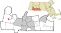
A map showing Blandford's location in Hampden County.
See also
 In Spanish: Blandford (condado de Hampden) para niños
