
Bloody Angle (battle) facts for kids
The Bloody Angle is a special part of the Battle Road in Lincoln, Massachusetts. Two important fights happened here on April 19, 1775. These battles were part of the battles of Lexington and Concord, which kicked off the American Revolutionary War.
This part of the road is called the "Bloody Angle" because of its shape. The road mostly goes east and west. But at this spot, it turns sharply north for about 500 yards, then turns sharply east again. This was the path the British soldiers took as they retreated from Concord back to Boston.
Quick facts for kids The Bloody Angle |
|||||
|---|---|---|---|---|---|
| Part of the American Revolutionary War | |||||
|
|||||
| Belligerents | |||||
| Massachusetts Bay | |||||
| Commanders and leaders | |||||
| Casualties and losses | |||||
| 4 killed | 30 killed or wounded | ||||
Contents
The Battle Road's Path
The Battle Road is now part of the Minute Man National Historical Park. This park helps us remember the important events of April 19, 1775. The fights along this road led up to the main battle at the Bloody Angle.
Key Spots on the Road
As the British soldiers marched, they met colonial militia groups. Here are some places they passed:
- Meriam's Corner (Lexington Road and Old Bedford Road), Concord: This was where the first big fight happened between the colonial militia and the British. It was around 12:30 PM. The fighting continued for the next eighteen miles.
- Grave of British soldiers: Some British soldiers who died were buried here.
The Bloody Angle Fight
The British soldiers soon reached the "Bloody Angle." Here, the road goes up a hill and makes a sharp left turn. It was a lightly wooded area.
Colonial militia from Woburn were waiting. They hid on one side of the road. Other militia groups came from Meriam's Corner. They positioned themselves on the other side. This trapped the British soldiers in a crossfire. More militia groups attacked from behind.
The road then made another sharp turn, this time to the right. Again, a large group of militiamen fired from both sides. The British soldiers were caught in a deadly trap.
Who Was Lost at the Angle
In these two sharp turns, the British lost about 30 soldiers. They were either killed or wounded. Four colonial militia members also died:
- Captain Jonathan Wilson from Bedford
- Captain Nathan Wyman from Billerica
- Lieutenant John Bacon from Natick
- Daniel Thompson from Woburn
The British soldiers managed to escape by running fast. The colonial fighters could not keep up through the woods and swamps. The colonial forces on the road were too crowded to make a strong attack from the back.
Continuing the Retreat
More militia groups from other towns kept arriving. The colonial forces grew to about 2,000 men. The road then straightened out. There were open fields and orchards along the sides.
Lieutenant Colonel Francis Smith, the British commander, sent soldiers to protect their sides. These "flankers" sometimes trapped militia members and caused injuries. But the British soldiers were also getting hurt. They were tired and running out of ammunition. The militiamen kept firing at them from a distance.
Images for kids
-
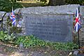
One of the grave sites of British soldiers
-
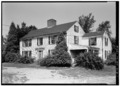
Samuel Brooks House

