Blue River (Oregon) facts for kids
Quick facts for kids Blue River |
|
|---|---|

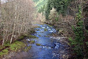
Flowing through the forest
|
|
|
Location of the mouth of the Blue River in Oregon
|
|
| Country | United States |
| State | Oregon |
| County | Lane and Linn |
| Physical characteristics | |
| Main source | Confluence of Wolf Creek and Mann Creek Willamette National Forest, Cascade Range, Linn County 2,504 ft (763 m) 44°17′41″N 122°10′17″W / 44.29472°N 122.17139°W |
| River mouth | McKenzie River Blue River, Lane County 1,040 ft (320 m) 44°09′15″N 122°20′42″W / 44.15417°N 122.34500°W |
| Length | 17 mi (27 km) |
| Basin features | |
| Basin size | 87 sq mi (230 km2) |
The Blue River is a beautiful river in Oregon, USA. It's a smaller river that flows into the McKenzie River. You can find it in Linn and Lane counties.
The river gets its start where two creeks, Mann Creek and Wolf Creek, meet in the Cascade Range mountains. From there, it flows generally southwest. It eventually joins the McKenzie River near the town of Blue River.
A big part of the Blue River is blocked by two dams, Saddle Dam and Blue River Dam. These dams create the Blue River Reservoir. This reservoir was built in 1968 by the United States Army Corps of Engineers. It helps with many things, like controlling floods and generating power.
Almost all of the river's surrounding land, called its watershed, is inside the Willamette National Forest. This forest is full of tall trees like western hemlock and Douglas-fir. The river was named "Blue River" because its clear water and rocky bottom often make it look strikingly blue!
River's Journey
The Blue River starts high up on the western side of the Cascade Range. It begins where Mann Creek and Wolf Creek join together. This spot is in Linn County, just north of the border with Lane County.
The river flows downhill from about 2,500 feet above sea level. It generally moves southwest through the Willamette National Forest. A road called Forest Road 15 follows the river for a long stretch.
As the river continues, it crosses into Lane County. It picks up water from smaller streams, like Quentin Creek and Cook Creek. Further along, it passes under Forest Road 15 again and gets more water from Tidbits Creek.
At one point, the river makes a sharp turn to the south. Forest Road 15 then runs along its left side. Before it reaches the Blue River Reservoir, it gets water from Mona Creek. It also passes under Forest Road 120, which leads to Mona Campground.
Just past Mona Creek, Lookout Creek joins the river from the left. This area is near Lookout Campground. The Blue River and its reservoir then curve southwest. Scott Creek flows into the river from the right side. On the opposite shore, you can see Saddle Dam and its boat launch.
As the Blue River gets closer to the main Blue River Dam, Quartz Creek and North Fork Quartz Creek add their waters. These enter from the right side of the river. Below the dam, Forest Road 125 runs next to the river.
The river flows past a special station that measures its water levels. Then, Simmonds Creek joins in from the right. Finally, the Blue River meets the McKenzie River at the community of Blue River. This meeting point is about 57 miles from where the McKenzie River joins the Willamette River.
 | James Van Der Zee |
 | Alma Thomas |
 | Ellis Wilson |
 | Margaret Taylor-Burroughs |


