Boile Run facts for kids
Quick facts for kids Boile Run |
|
|---|---|

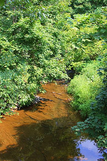
Boile Run in its lower reaches
|
|
| Other name(s) | Boyle Run |
| Physical characteristics | |
| Main source | pond or small lake at the base of Little Mountain in Lower Augusta Township, Northumberland County, Pennsylvania between 760 and 780 feet (232 and 238 m) |
| River mouth | Susquehanna River in Lower Augusta Township, Northumberland County, Pennsylvania 413 ft (126 m) 40°45′31″N 76°50′30″W / 40.7585°N 76.8418°W |
| Length | 4.7 mi (7.6 km) |
| Basin features | |
| Progression | Susquehanna River → Chesapeake Bay |
| Basin size | 5.97 sq mi (15.5 km2) |
| Tributaries |
|
Boile Run (also known as Boyle Run) is a small stream in Northumberland County, Pennsylvania. It flows into the Susquehanna River. The stream is about 4.7 miles (7.6 km) long. It runs through Lower Augusta Township.
The area of land that drains into Boile Run is 5.97 square miles (15.5 km2). This stream is considered healthy and clean. It is a good place for fish to live and for migrating fish to pass through.
Contents
Where Does Boile Run Flow?
Boile Run starts in a pond or small lake. This lake is at the base of Little Mountain. The stream is located in Lower Augusta Township.
It flows generally west, winding through a valley. Along its path, it passes another small lake. Several smaller streams, called tributaries, join Boile Run. These tributaries add more water to the main stream.
Eventually, Boile Run leaves its valley. It crosses Pennsylvania Route 147 and a railroad track. Finally, it flows into the Susquehanna River. This meeting point is about 116.32 miles (187.20 km) upstream from the Susquehanna River's mouth.
How Clean is Boile Run?
Boile Run is a healthy stream. It is not listed as a polluted water body. This means its water quality is good.
Sometimes, a special permit allows a small amount of treated wastewater to enter one of its tiny side streams. This comes from a single home.
The amount of water flowing in Boile Run can change. During heavy rains, the water level rises. For example, there's a 10 percent chance the water flow could reach 1,000 cubic feet per second (28 m3/s) in a year.
What is the Land Like Around Boile Run?
Boile Run is a small stream. Its mouth, where it meets the Susquehanna River, is 413 feet (126 m) above sea level. The stream's source, where it begins, is higher up. It is between 760 and 780 feet (230 and 240 m) above sea level.
The stream's starting point is west of a place called Resler. Its end point is south of Fishers Ferry.
The Boile Run Watershed
The watershed of Boile Run covers 5.97 square miles (15.5 km2). A watershed is all the land where water drains into a particular stream or river. Boile Run's watershed is entirely within the Sunbury area map.
The main purpose of this stream is to support aquatic life. This means it's important for fish and other water creatures. Boile Run is one of two main streams in Lower Augusta Township. The other is Hallowing Run.
In June 1972, there was a flood on Boile Run.
A Look at Boile Run's History
The name Boile Run was officially recorded on August 2, 1979. Its official ID number is 1169949. You might also see it called Boyle Run. This name appeared on a map in 1953.
The original spelling, "Boile Run," was used on maps as early as 1874. Later, some maps mistakenly changed it to "Boyle Run." In 1965, experts suggested that "Boile Run" should be the official name.
Many of the first settlers in the Boile Run valley were of Scotch-Irish background. A man named John Snyder built a mill on the stream in 1858. He ran the mill until it burned down in 1880.
Over the years, several bridges have been built over Boile Run. The oldest one still standing was built in 1922. Many other bridges were built in the 1930s, 1960s, 1980s, and 1990s. These bridges help roads like State Route 4022 and Pennsylvania Route 147 cross the stream safely.
Animals and Plants in Boile Run
The area around Boile Run is important for fish. It is known as a Warmwater Fishery. This means it's a good home for fish that prefer warmer water. It's also a Migratory Fishery. This means fish that travel long distances use the stream.
 | Bayard Rustin |
 | Jeannette Carter |
 | Jeremiah A. Brown |


