Bolivia, North Carolina facts for kids
Quick facts for kids
Bolivia, North Carolina
|
|
|---|---|

Post office
|
|
| Country | |
| State | |
| County | Brunswick |
| Named for | Bolivia |
| Area | |
| • Total | 0.64 sq mi (1.65 km2) |
| • Land | 0.64 sq mi (1.65 km2) |
| • Water | 0.00 sq mi (0.00 km2) |
| Elevation | 39 ft (12 m) |
| Population
(2020)
|
|
| • Total | 149 |
| • Density | 234.28/sq mi (90.42/km2) |
| Time zone | UTC-5 (Eastern (EST)) |
| • Summer (DST) | UTC-4 (EDT) |
| ZIP code |
28422
|
| Area codes | 910, 472 |
| FIPS code | 37-06820 |
| GNIS feature ID | 2405298 |
Bolivia is a small town located in Brunswick County, North Carolina, in the United States. It is special because it is the county seat of Brunswick County. This means it is where the main government offices for the county are located. In 2020, about 149 people lived there.
Contents
History of Bolivia
Bolivia was first settled by European Americans in the 1890s. It officially became a town, or was incorporated, in 1911.
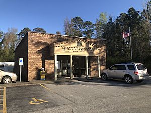
There's an interesting story about how the town got its name. One idea is that many boxes shipped from the area had the word "Bolivia" on them. This referred to the country in South America, and people in the area liked the name. A post office has been operating in Bolivia since 1892.
On January 6, 1960, a plane called National Airlines Flight 2511 had an accident over Bolivia. This event is a part of the town's history.
Later, a major road called U.S. 17 was made wider. A new section of the highway was built around Bolivia. This was meant to help traffic flow better. However, it also meant that fewer visitors and shoppers came into the town directly. This caused some economic challenges for Bolivia.
To help the town, the county decided to move its main government center, the county seat, to Bolivia in 1977. Before this, the county seat was in Southport. Having the government offices in Bolivia helped bring new businesses and growth to the town.
Geography of Bolivia
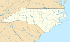
Bolivia is located in North Carolina. The old part of U.S. Route 17, also known as Old Ocean Highway, goes right through the middle of the town. The newer, wider U.S. Route 17, called Ocean Highway, goes around the town to the northwest.
- U.S. Route 17 goes about 18 miles (29 km) northeast to Wilmington.
- It also goes about 53 miles (85 km) southwest to Myrtle Beach, South Carolina.
According to the United States Census Bureau, the town of Bolivia covers a total area of about 0.64 square miles (1.6 square kilometers). All of this area is land.
Population Information
The word demographics refers to information about the people who live in a place, like their numbers and how they are grouped. Here's how Bolivia's population has changed over the years:
| Historical population | |||
|---|---|---|---|
| Census | Pop. | %± | |
| 1920 | 199 | — | |
| 1930 | 156 | −21.6% | |
| 1940 | 203 | 30.1% | |
| 1950 | 215 | 5.9% | |
| 1960 | 201 | −6.5% | |
| 1970 | 185 | −8.0% | |
| 1980 | 252 | 36.2% | |
| 1990 | 228 | −9.5% | |
| 2000 | 148 | −35.1% | |
| 2010 | 143 | −3.4% | |
| 2020 | 149 | 4.2% | |
| 2023 (est.) | 227 | 58.7% | |
| U.S. Decennial Census | |||
2020 Census Details
The 2020 United States census counted 149 people living in Bolivia. There were 71 households, which means 71 different homes or families living together. Out of these, 54 were considered families.
See also
 In Spanish: Bolivia (Carolina del Norte) para niños


