Boodua, Queensland facts for kids
Quick facts for kids BooduaQueensland |
|||||||||||||||
|---|---|---|---|---|---|---|---|---|---|---|---|---|---|---|---|

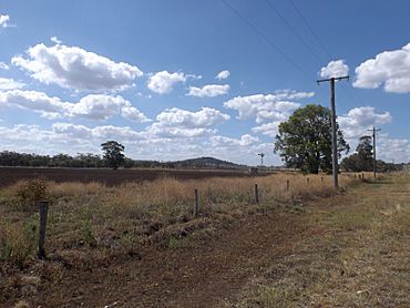
Fields along Kingsthorpe Haden Road
|
|||||||||||||||
| Population | 95 (2021 census) | ||||||||||||||
| • Density | 3.893/km2 (10.08/sq mi) | ||||||||||||||
| Postcode(s) | 4401 | ||||||||||||||
| Area | 24.4 km2 (9.4 sq mi) | ||||||||||||||
| Time zone | AEST (UTC+10:00) | ||||||||||||||
| LGA(s) | Toowoomba Region | ||||||||||||||
| State electorate(s) | Condamine | ||||||||||||||
| Federal Division(s) | Groom | ||||||||||||||
|
|||||||||||||||
Boodua is a small rural area, also known as a locality, in the Toowoomba Region of Queensland, Australia. It's a quiet place where most of the land is used for farming. In 2021, about 95 people lived in Boodua.
Contents
Where is Boodua?
Boodua is located in a farming area. A stream called Oakey Creek runs along parts of its eastern and southern edges. This creek eventually flows into the Condamine River. Most of the land here is used for growing crops or raising animals.
Boodua's Story
The name "Boodua" comes from the Boodua railway station, which was part of the Haden railway line. The word "Boodua" is an Aboriginal word for a type of hawk.
The Old School House
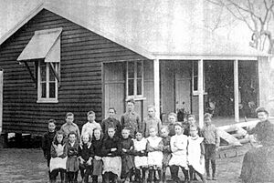
A school called East Lynne Provisional School first opened its doors on 1 October 1908. It became East Lynne State School in 1909. Later, in 1926, its name changed to Boodua State School. The school closed on 29 January 1963. It was located at 5 Boodua West Road.
Community Gatherings
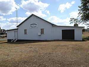
The Boodua Public Hall opened in 1909 and was originally known as the East Lynne Hall. This hall has been a place for community events for over a century.
In 1913, the East Lynne Methodist Church was officially opened. It was a building about 20 by 30 feet (6.1 by 9.1 metres) and was built near the railway line, close to the state school and the public hall. The church no longer exists today.
Dairy Days
Between 1926 and 1950, the Darling Downs Co-operative Dairy Association ran a cheese factory in Boodua. This shows how important farming and dairy were to the area's history.
Local Government Changes
Boodua was once part of the Shire of Rosalie. However, in 2008, the Shire of Rosalie joined with other areas to form the larger Toowoomba Region.
What's in Boodua Today?
The main community building in Boodua is the Boodua Public Hall. You can find it at 1473 Kingsthorpe Haden Road, right on the corner of Boodua West Road. It continues to be a central spot for the local community.
 | Selma Burke |
 | Pauline Powell Burns |
 | Frederick J. Brown |
 | Robert Blackburn |


