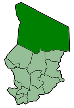
Bourkou-Ennedi-Tibesti facts for kids
Bourkou-Ennedi-Tibesti was a very large administrative area, or "prefecture," in the northern part of the country of Chad. It was one of fourteen such prefectures that helped organize Chad. The main city and capital of Bourkou-Ennedi-Tibesti was Faya. This system of prefectures was used in Chad until 2002. After that, Chad changed how it divided its land, moving to a new system of "regions."
Contents
What Was Bourkou-Ennedi-Tibesti?
Bourkou-Ennedi-Tibesti, often shortened to BET, was a huge part of Chad. It covered a vast desert area in the north. Imagine a place with wide-open spaces, sand dunes, and rocky mountains. That's a bit like what BET was. It was known for its unique landscapes and its important role in Chad's history.
Understanding Prefectures
A prefecture is like a big district or a large county within a country. Governments use these divisions to help manage different parts of the country. Each prefecture had its own capital city, which was the center for local government and services. This system helped the central government in Chad reach out to people in all corners of the country. It made it easier to provide things like education, healthcare, and security.
Where Was This Region?
Bourkou-Ennedi-Tibesti was located in the northern part of Chad. This area is mostly covered by the Sahara Desert. It includes parts of the Tibesti Mountains, which are volcanic and quite dramatic. The region also had the Ennedi Plateau, known for its amazing rock formations. Life in this desert environment can be tough, but it is also home to unique wildlife and hardy people. The vastness of BET meant it shared borders with several other countries. These included Libya to the north and Sudan to the east.
Chad's Changing Map
Countries often change how they divide their land over time. This happens for many reasons. It might be to make government services work better. Or it could be to reflect changes in population or economic activity. Chad is a country in Central Africa. It has a long history of adapting its administrative structure.
From Prefectures to Regions
In 2002, Chad decided to update its administrative map. The country moved from having 14 prefectures to having 22 new areas called "regions." This change was part of a bigger plan to improve how the government worked. It aimed to bring services closer to the people. The old Bourkou-Ennedi-Tibesti prefecture was split into three new regions. These new regions are called Borkou, Ennedi-Est, Ennedi-Ouest, and Tibesti. This shows how large the original prefecture was. Each new region now has its own capital and local government.
Faya-Largeau: The Capital City
Faya-Largeau was the capital city of the Bourkou-Ennedi-Tibesti prefecture. It is still an important city in northern Chad today. Faya-Largeau is located in an oasis, which is a fertile spot in the desert where water can be found. This makes it a vital stop for travelers and traders. The city has a long history as a trading post. It also played a role in various conflicts in the region. Today, Faya-Largeau serves as a key administrative and military center for the Borkou region.
|
|||
|
Batha · Biltine · Borkou-Ennedi-Tibesti · Chari-Baguirmi · Guéra · Kanem · Lac · Logone Occidental · Logone Oriental · Mayo-Kébbi · Moyen-Chari · Ouaddaï · Salamat · Tandjilé · |
|||
|
See also : Regions of Chad - Departments of Chad |
 | Stephanie Wilson |
 | Charles Bolden |
 | Ronald McNair |
 | Frederick D. Gregory |


