Bosconia facts for kids
Quick facts for kids
Bosconia
|
|||
|---|---|---|---|
|
Municipality and town
|
|||
|
|||

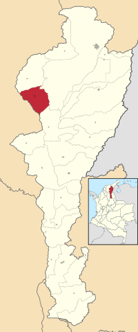
Location of the municipality and town of Bosconia in the Department of Cesar.
|
|||
| Country | Colombia | ||
| Region | Caribbean | ||
| Department | Cesar | ||
| Foundation | 1958 | ||
| Area | |||
| • Municipality and town | 586.2 km2 (226.3 sq mi) | ||
| • Urban | 9.65 km2 (3.73 sq mi) | ||
| Population
(2020 est.)
|
|||
| • Municipality and town | 43,326 | ||
| • Urban | 40,562 | ||
| • Urban density | 4,203.3/km2 (10,887/sq mi) | ||
| Time zone | UTC-5 | ||
| Website | www.bosconia.gov.co/ |
||
Bosconia is a lively town and a special kind of local government area called a municipality in Colombia. It's located in the Cesar Department, which is a part of Colombia.
Contents
Exploring Bosconia's Location
Bosconia is found in the northwestern part of the Cesar Department. It shares its borders with several other towns.
Where is Bosconia Located?
To the north, Bosconia borders El Copey. To the east, it's next to Valledupar. If you go south, you'll find El Paso.
Natural Borders and Area
To the west, the Magdalena Department is separated from Bosconia by the Ariguaní River. This river acts as a natural border. The total area of the municipality of Bosconia is about 609 square kilometers. The main town of Bosconia is right in the middle of this area.
What is Bosconia's Climate Like?
Bosconia has a warm climate. The average temperature throughout the year is around 31 °C (88 °F). It experiences two rainy seasons and two dry seasons, which switch places during the year.
Bosconia's Interesting History
The town of Bosconia has a fascinating story. It started as a small settlement and grew into an important hub.
How Bosconia Began
Bosconia was founded on August 20, 1958. Two people, Enrique Arón Ayén and Agustin Mackenzie, started the town. They named it in honor of Saint John Bosco, a respected Catholic church priest.
The Train Station and Growth
In its early days, Bosconia became a train station stop. This was very helpful for local farmers. They could easily transport their goods by train. This made the village grow and become more important.
Becoming a Municipality
In 1979, Bosconia officially became a municipality. This means it gained its own local government. It could then manage its own affairs within the Cesar Department.
The Famous "Bosconia's T"
Later, new paved highways were built. Bosconia became a major intersection for two important Colombian roads. One highway connects the northern departments of La Guajira and Cesar with the rest of Colombia. The other road links the northeast and the rest of Colombia to the Caribbean Sea cities like Santa Marta and Barranquilla. These two highways cross paths in downtown Bosconia. This intersection is now famously known as "Bosconia's T".
See also
 In Spanish: Bosconia para niños
 | Sharif Bey |
 | Hale Woodruff |
 | Richmond Barthé |
 | Purvis Young |


