Bottle Cove facts for kids
Quick facts for kids
Bottle Cove
|
|
|---|---|
|
Fishing Village
|
|
| Country | |
| Province | |
| Population
(2006)
|
|
| • Total | Approx. 10 |
| Time zone | UTC-3:30 (Newfoundland Time) |
| • Summer (DST) | UTC-2:30 (Newfoundland Daylight) |
| Area code(s) | 709 |
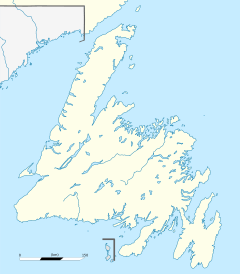
Bottle Cove is a small, beautiful place on the west coast of Newfoundland. It opens right into the Gulf of Saint Lawrence. People often include it in the "Bay of Islands" area. You might also hear it called Bottle Cove Provincial Park or Bottle Cove Day Park. It's a popular spot for both locals and visitors. People love it for its wild and natural beauty.
Bottle Cove is in the Newfoundland Time Zone. This means it's 3.5 hours behind UTC. Like many places, it uses daylight saving time in the warmer months. The weather here is a humid continental climate. In winter, the average daytime temperature is around 0 degrees Celsius (32 degrees Fahrenheit). Summer days average about 16 degrees Celsius (61 degrees Fahrenheit).
History of Bottle Cove
There isn't much written history about Bottle Cove specifically. But some small clues have been found. For example, an arrow flint point was discovered in 1971. This suggests that people from the Little Passage culture might have used the cove. They lived here around 1200 to 1500 AD.
People believe Bottle Cove was a French fishing station starting in the early 1500s. A fishing station was a temporary base. Fishermen would set up camp for the season. Then they would return home when fishing was over. Bottle Cove is close to Port-aux-Basques. This was a fishing spot for Basque fishermen in the 1400s. So, it's likely Basque fishermen visited Bottle Cove first.
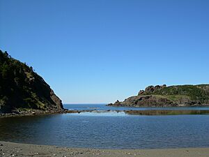
The name "Bottle Cove" comes from the French word "bateau," which means "boat." But "Bottle" also fits the cove well. It has an almost perfect circular shape. Its narrow opening to the Gulf makes it look like a bottle.
In 1891, records show 38 people lived in Bottle Cove. By 1921, there were seven families, totaling 42 people. The cove was used as a port for local fishermen for many years. But in the 1970s, Little Port was built nearby. It became a modern and safe harbor for boats. Today, you can still see a few old fishing sheds along the shore. There are also about six homes in the cove itself.
Bottle Cove, along with nearby Lark Harbour and York Harbour, were outport settlements. This means they were isolated communities. People relied on boats for supplies and services. But in 1961, a road (Route 450) was built to Corner Brook. This connected the communities to the outside world. They no longer needed boats for everything. Telephones arrived in the early 1970s. Today, there's still no cell phone service. Internet and TV come through satellite dishes. You can find free community internet at the Lark Harbour Library.
Explore Bottle Cove's Wonders
Captain James Cook mapped this area in 1776. A stone marker, called a cairn, is on the northern headland of Bottle Cove. It marks what Cook called "Trail's End." This was the farthest point of the Humber Arm that Cook mapped. Locals say that Cook's detailed maps are still used by sailors today.
Bottle Cove is famous for its amazing geology. The cliffs around the cove are part of the Appalachian Mountains. Many rocks here are from a huge layer called the "Humber Arm Allochthon." This rock layer was pushed up during tectonic plate movement. As it moved, shales underneath broke apart. They mixed with other rocks to form something called "mélange."
You can also see dark green and red basalt pillow lavas at low tide. These rounded, lumpy rocks formed underwater. The sea has carved these different rocks into cool and interesting shapes. At low tide, you can even walk to a sea-carved "cave" on the south side of the cove.
Bottle Cove also has a raised wave-cut platform. This flat rock area was formed by waves. It happened when glaciers melted about 13,000 years ago. The sea level was much higher then. Waves and frost carved this platform into the solid rock. As the glaciers disappeared, the land rose up. This left the old shoreline high and dry. This platform is part of one of the cove's headlands.
Walking Trails Around Bottle Cove
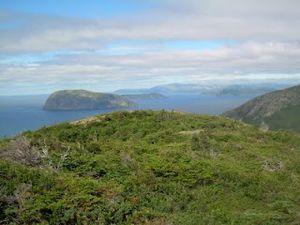
In recent years, new walking trails have been built near Bottle Cove. The Outer Bay of Islands Enhancement Committee helped create them. These trails are easy to follow. They include long wooden boardwalks and paths through the bush. They vary in length and difficulty. Some are short 15-minute strolls on flat ground. Others are half-day hikes. The difficulty ranges from easy to extreme.
Popular hikes near Bottle Cove include:
- Little Port Head (some parts are very challenging)
- South Head Lighthouse (medium difficulty)
- Cedar Cove (easy to medium difficulty)
- Trail End (marks where Captain Cook finished mapping the Bay of Islands)


