Brannon Run (East Branch Oil Creek tributary) facts for kids
Quick facts for kids Brannon Run |
|
|---|---|
| Other name(s) | Tributary to East Branch Oil Creek |
| Country | United States |
| State | Pennsylvania |
| County | Crawford |
| Township | Rome |
| Physical characteristics | |
| Main source | divide between Brannon Run and McLaughlin Creek about 2 miles east of Centerville, Pennsylvania 1,490 ft (450 m) 41°43′53″N 079°42′03″W / 41.73139°N 79.70083°W |
| River mouth | East Branch Oil Creek about 1.5 miles northeast of Centerville, Pennsylvania 1,299 ft (396 m) 41°45′25″N 079°44′00″W / 41.75694°N 79.73333°W |
| Length | 2.56 mi (4.12 km) |
| Basin features | |
| Progression | northwest |
| River system | Allegheny River (Oil Creek) |
| Basin size | 3.11 square miles (8.1 km2) |
| Tributaries |
|
| Bridges | Fink Road, Buells Corners Road, Fish Flats Road |
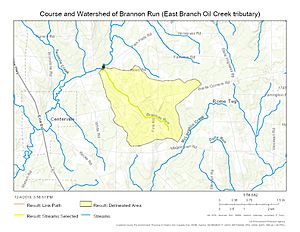
Brannon Run is a small stream, about 2.56 mi (4.12 km) long. It flows into East Branch Oil Creek. You can find it in Crawford County, Pennsylvania.
Where Brannon Run Starts and Ends
Brannon Run begins in a place called the McLaughlin Creek divide. This is about 2 miles east of Centerville, Pennsylvania. From there, the stream flows towards the northwest. It travels through an area known as the Erie Drift Plain. Finally, Brannon Run joins East Branch Oil Creek. This meeting point is about 1.5 miles northeast of Centerville.
Understanding the Brannon Run Area
The area that Brannon Run drains is called its watershed. This watershed covers about 3.11 square miles (8.1 km2). A watershed is like a big bowl where all the rain and snow melt flow into one stream or river. In the Brannon Run watershed, a lot of the land is covered by forests. About 60% of this area is forested, which means it has many trees.
Maps and Images
 | Calvin Brent |
 | Walter T. Bailey |
 | Martha Cassell Thompson |
 | Alberta Jeannette Cassell |


