Branson West, Missouri facts for kids
Quick facts for kids
Branson West, Missouri
|
|
|---|---|

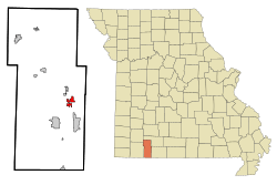
Location of Branson West, Missouri
|
|
| Country | United States |
| State | Missouri |
| County | Stone |
| Area | |
| • Total | 4.72 sq mi (12.22 km2) |
| • Land | 4.72 sq mi (12.22 km2) |
| • Water | 0.00 sq mi (0.00 km2) |
| Elevation | 1,368 ft (417 m) |
| Population
(2020)
|
|
| • Total | 484 |
| • Density | 102.56/sq mi (39.60/km2) |
| Time zone | UTC-6 (Central (CST)) |
| • Summer (DST) | UTC-5 (CDT) |
| ZIP code |
65737
|
| Area code(s) | 417 |
| FIPS code | 29-07989 |
| GNIS feature ID | 1669588 |
Branson West is a small city in Stone County, Missouri, United States. It is located in the southwestern part of the state. In 2020, the city had a population of 484 people.
Contents
A Brief History of Branson West
Branson West wasn't always called that! It was first known as Linchpin. Later, it was officially named Lakeview. This name stayed until February 25, 1992.
The city then changed its name to Branson West. This was done to connect with the fast-growing city of Branson nearby. This change helped the city grow a lot at first. Its population jumped from 37 people in 1990 to 408 people by 2000.
However, the growth has slowed down since then. This is partly because the town is a bit isolated. It also doesn't have as many shops or services as larger cities.
Where is Branson West Located?
Branson West is located at specific coordinates: 36.704978 degrees North and -93.371245 degrees West. These numbers help pinpoint its exact spot on a map.
The United States Census Bureau says the city covers a total area of about 4.49 square miles (12.22 square kilometers). All of this area is land, meaning there are no large lakes or rivers within the city limits.
Who Lives in Branson West?
Branson West is part of the Branson, Missouri Micropolitan Statistical Area. This means it's part of a larger area that includes Branson and other nearby towns.
Population Changes Over Time
The city's population has changed quite a bit over the years.
| Historical population | |||
|---|---|---|---|
| Census | Pop. | %± | |
| 1980 | 58 | — | |
| 1990 | 37 | −36.2% | |
| 2000 | 408 | 1,002.7% | |
| 2010 | 478 | 17.2% | |
| 2020 | 484 | 1.3% | |
| U.S. Decennial Census | |||
As you can see, the population grew a lot between 1990 and 2000. It has continued to grow, but at a slower pace.
A Look at the 2010 Census
In 2010, there were 478 people living in Branson West. These people lived in 179 households. A household is a group of people living together in one home. Most of these households (127) were families.
The city had about 106.5 people per square mile. There were also 215 housing units, which are places where people can live.
Most of the people in Branson West (91.4%) were White. About 11.9% of the population identified as Hispanic or Latino.
About 28% of the residents were under 18 years old. This means many young people and families live in the city. The average age in the city was 36.4 years.
Branson West Airport
Branson West has its own airport, called Branson West Airport. It's also known as Branson West Municipal Airport. This airport is owned by the city and is open for public use. It is located about two nautical miles (3.7 kilometers) west of the city center.
The airport is sometimes called Emerson Field. This name honors Robert Emerson, who was an aviator and a previous owner of the land.
The airport received a large federal grant of $16 million to help build it. It is a general aviation airport. This means it is mainly used for private planes and charter flights, not large commercial passenger jets.
The airport was built on 200 acres (0.81 square kilometers) of land. This land was given by a company called Conco Companies. The city also bought another 40 acres (0.16 square kilometers) for safety zones around the runway. More land was donated for future growth and for a natural area to protect the environment.
See also
 In Spanish: Branson West (Misuri) para niños

