Brewerton, New York facts for kids
Quick facts for kids
Brewerton, New York
|
|
|---|---|

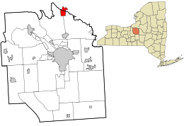
Location in Onondaga County and the state of New York.
|
|
| Country | United States |
| State | New York |
| Counties | Onondaga, Oswego |
| Area | |
| • Total | 3.33 sq mi (8.64 km2) |
| • Land | 3.17 sq mi (8.20 km2) |
| • Water | 0.17 sq mi (0.44 km2) |
| Elevation | 384 ft (117 m) |
| Population
(2020)
|
|
| • Total | 3,907 |
| • Density | 1,234.05/sq mi (476.51/km2) |
| Time zone | UTC-5 (Eastern (EST)) |
| • Summer (DST) | UTC-4 (EDT) |
| ZIP code |
13029
|
| Area code(s) | 315 |
| FIPS code | 36-08059 |
| GNIS feature ID | 0944698 |
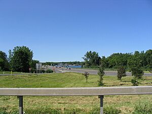
Brewerton is a small community, also called a "census-designated place" (CDP). It is located in the state of New York. Brewerton is special because it sits right where Oneida Lake flows into the Oneida River. In 2020, about 3,907 people lived there. Long ago, in the 1800s, this area was sometimes called Fort Brewerton.
History of Brewerton
Brewerton is located near an old fort called Fort Brewerton. This fort was built in 1759. Its job was to protect the path from Albany to the port of Oswego.
The first settlers arrived in 1789. They came to trade animal furs. Today, you can visit the Fort Brewerton Block House Museum. It has many old items from the area. Some items are even from the time of the Paleo-Indians. The museum is right next to the original fort.
In the late 1700s, two religious leaders, Rev. John Shepard and Deacon George Ramsey, began teaching here. Deacon Ramsey built a schoolhouse. It was used for both learning and worship.
In 1948, the Brewerton Speedway was built. It was a dirt track for racing cars. There were plans for another track, but it was never finished.
Fort Brewerton was added to the National Register of Historic Places in 1973. This means it is a very important historical site.
Geography and Location
Brewerton is located at 43°14′15″N 76°8′22″W / 43.23750°N 76.13944°W. It sits on the Oneida River at the western end of Oneida Lake.
The community covers about 3.3 square miles (8.6 square kilometers). Most of this area is land, with a small part being water.
Brewerton is home to the largest elementary school in the Central Square School District. This school district is one of the biggest in New York State.
Two major roads, U.S. Route 11 and Interstate 81, pass through Brewerton. These roads connect it to Watertown in the north and Syracuse in the south.
In 2007, the town of Cicero changed Brewerton's official boundaries. This was done to help Brewerton get money from federal grants. New homes had made the area too developed for certain funds.
Brewerton has become a popular spot for fishing on Oneida Lake. Many fishing events, like the Bass Masters outings, happen at Oneida Shores County Park.
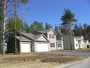
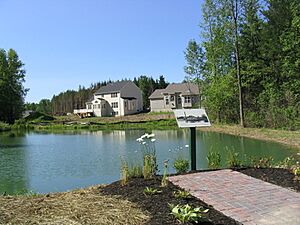
New housing areas like Miralago and Champlain at the Lake are also growing in Brewerton.
Population Facts
| Historical population | |||
|---|---|---|---|
| Census | Pop. | %± | |
| 2020 | 3,907 | — | |
| U.S. Decennial Census | |||
In 2010, about 4,029 people lived in Brewerton. There were 1,644 households, which are groups of people living together.
The population was spread out by age. About 28% of the people were under 19 years old. Around 10.8% were 65 years or older. The average age for people in Brewerton was about 37 years old.
The average income for a household in Brewerton was about $56,143 between 2010 and 2014.
See also
 In Spanish: Brewerton para niños
 | Valerie Thomas |
 | Frederick McKinley Jones |
 | George Edward Alcorn Jr. |
 | Thomas Mensah |


