Darby Township, Pennsylvania facts for kids
Quick facts for kids
Darby Township
|
|
|---|---|
|
First Class Township
|
|

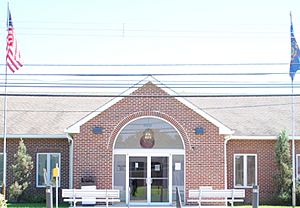
Darby Township Municipal Building in Darby Township
|
|

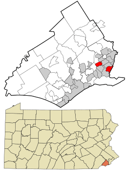
Location in Delaware County and the state of Pennsylvania.
|
|

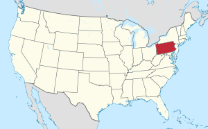
Location of Pennsylvania in the United States
|
|
| Country | United States |
| State | Pennsylvania |
| County | Delaware |
| Settled | 1682 |
| Area | |
| • Total | 1.42 sq mi (3.68 km2) |
| • Land | 1.42 sq mi (3.67 km2) |
| • Water | 0.01 sq mi (0.02 km2) |
| Elevation | 89 ft (27 m) |
| Population
(2010)
|
|
| • Total | 9,264 |
| • Estimate
(2016)
|
9,297 |
| • Density | 6,565.68/sq mi (2,535.84/km2) |
| Time zone | UTC-5 (EST) |
| • Summer (DST) | UTC-4 (EDT) |
| Area code(s) | 610 |
| FIPS code | 42-045-18160 |
Darby Township is a community located in Delaware County, Pennsylvania, in the United States. It's a type of local government called a township. In 2010, about 9,264 people lived here.
This township has both homes and large business areas. Many shipping companies like the industrial areas because they are close to the Philadelphia International Airport. A unique thing about Darby Township is that it's made of two separate parts. To get from one part to the other, you have to drive through other towns! Darby Township is different from nearby places with similar names, like Darby Borough and Upper Darby Township.
Contents
History of Darby Township
Early Beginnings
The area that is now Darby Township was settled very soon after William Penn arrived in 1682. By 1683, it was known as one of the first places where people had permanently settled. Even so, not many people lived there for a long time.
In 1682, the Darby Friends' Meeting, a religious group, was started. That same year, Darby was first mentioned in official records. Two people, Thomas Worth and Joshua Fearne, were chosen to collect money to build a courthouse for Darby.
How Darby Township Was Divided
The area that now makes up both Upper and Lower Darby was once one big government area. In 1747, people decided to split the upper part from the lower part to make things easier. This split was for most things, except for collecting money to help the poor.
The lines they drew then are not the same as the township lines today. Forty years later, people asked the court to make the division official. They wanted the lower part to be called Darby and the upper part to be called Upper Darby.
Geography of Darby Township
Darby Township is located at 39°54′28″N 75°17′21″W / 39.90778°N 75.28917°W.
The township covers about 1.4 square miles (3.7 km2). Most of this area is land, with a very small amount of water. As mentioned, Darby Township is special because it has two separate parts. Other towns are located in between these two parts.
Darby Township shares its borders with nine different towns and cities. These include the City of Philadelphia, Sharon Hill Borough, Colwyn Borough, Folcroft Borough, Glenolden Borough, Ridley Township, Upper Darby Township, Aldan Borough, and Collingdale Borough.
People of Darby Township
| Historical population | |||
|---|---|---|---|
| Census | Pop. | %± | |
| 1930 | 2,773 | — | |
| 1940 | 2,899 | 4.5% | |
| 1950 | 3,454 | 19.1% | |
| 1960 | 12,598 | 264.7% | |
| 1970 | 13,603 | 8.0% | |
| 1980 | 12,264 | −9.8% | |
| 1990 | 10,955 | −10.7% | |
| 2000 | 9,622 | −12.2% | |
| 2010 | 9,264 | −3.7% | |
| 2020 | 9,219 | −0.5% | |
| U.S. Decennial Census | |||
Population and Diversity
In 2010, there were 9,264 people living in Darby Township. There were 3,731 households, which are groups of people living together in one home. The township has a diverse population.
About 24% of the people were under 18 years old. The average age of people in the township was 37.4 years.
The average income for a household in the township was about $37,396. For families, the average income was around $43,357.
Getting Around Darby Township
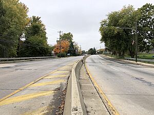
As of 2018, Darby Township has about 16.52 miles of public roads. Most of these roads are taken care of by the township itself. Some main roads include Hook Road and Oak Lane.
The SEPTA public transportation system provides bus service to Darby Township. You can catch buses like Route 107, Route 113, and Route 115. These buses connect Darby Township to other places like the 69th Street Transportation Center, Claymont station, and the Philadelphia International Airport.
Education in Darby Township
Students in Darby Township attend schools within the Southeast Delco School District.
- Younger students start at the Kindergarten Center, which is located right in Darby Township.
- Most students in grades 1-8 go to Darby Township School, also located in the township. Some students might go to Delcroft School or Sharon Hill School.
- For high school, students attend Academy Park High School, which is in Sharon Hill Borough.
Darby Township also has two public libraries where you can borrow books and learn new things. These are the Lee Taliaferro Library and the Loretta Touni Library.
Fire Companies
Darby Township and its nearby communities are protected by three volunteer fire companies. These companies are made up of people who volunteer their time to help keep the community safe from fires and other emergencies.
- Two of these companies, the Briarcliffe Fire Company and the Goodwill Fire Company, are located in the northern part of Darby Township.
- The Briarcliffe Fire Company has two fire engines, an ambulance, and a utility vehicle.
- The Goodwill Fire Company has a ladder truck, a pumper truck, a mini-pumper, and a transport utility vehicle.
- Darby Township Fire Company No. 4 is in the southern part of the township. It has two firetrucks and a pickup truck.
See also
 In Spanish: Municipio de Darby (Pensilvania) para niños


