Brownington, Missouri facts for kids
Quick facts for kids
Brownington, Missouri
|
|
|---|---|

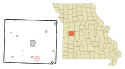
Location of Brownington, Missouri
|
|
| Country | United States |
| State | Missouri |
| County | Henry |
| Area | |
| • Total | 0.12 sq mi (0.31 km2) |
| • Land | 0.12 sq mi (0.31 km2) |
| • Water | 0.00 sq mi (0.00 km2) |
| Elevation | 748 ft (228 m) |
| Population
(2020)
|
|
| • Total | 71 |
| • Density | 586.78/sq mi (226.14/km2) |
| Time zone | UTC-6 (Central (CST)) |
| • Summer (DST) | UTC-5 (CDT) |
| FIPS code | 29-08902 |
| GNIS feature ID | 2396610 |
| Website | no website |
Brownington is a small town located in Henry County, Missouri, in the United States. In 2020, about 71 people lived there. It is a quiet place with an interesting past.
Contents
History of Brownington
The town of Brownington was first established in 1869. It was planned out by a person named William N. Doyle. Before Brownington, another community called Consville was founded in 1867. Over time, these two communities joined together to form the town we know today.
Where is Brownington?
Brownington is located in Henry County, Missouri. According to the United States Census Bureau, the town covers a total area of about 0.31 square kilometers (0.12 square miles). All of this area is land, meaning there are no large bodies of water within the town limits.
Who Lives in Brownington?
The number of people living in Brownington has changed over the years. A census is a count of all the people living in a place. It helps us understand how communities grow or shrink.
Brownington's Population Over Time
Here is a look at how Brownington's population has changed since 1880:
| Historical population | |||
|---|---|---|---|
| Census | Pop. | %± | |
| 1880 | 251 | — | |
| 1890 | 329 | 31.1% | |
| 1900 | 407 | 23.7% | |
| 1910 | 348 | −14.5% | |
| 1920 | 333 | −4.3% | |
| 1930 | 266 | −20.1% | |
| 1940 | 261 | −1.9% | |
| 1950 | 179 | −31.4% | |
| 1960 | 130 | −27.4% | |
| 1970 | 95 | −26.9% | |
| 1980 | 112 | 17.9% | |
| 1990 | 84 | −25.0% | |
| 2000 | 119 | 41.7% | |
| 2010 | 107 | −10.1% | |
| 2020 | 71 | −33.6% | |
| U.S. Decennial Census | |||
A Look at the 2010 Census
In 2010, the census showed that 107 people lived in Brownington. These people lived in 45 different homes, and 32 of these were families. The town had 50 housing units in total.
Most of the people in Brownington were White (95.3%). A smaller number were Native American (2.8%), and some were from two or more racial backgrounds (1.9%).
Out of the 45 homes:
- 24.4% had children under 18 living there.
- 46.7% were married couples living together.
- 17.8% had a female head of the house with no husband present.
- 6.7% had a male head of the house with no wife present.
- 28.9% were not families.
About 24.4% of all homes had only one person living in them. Only 4.4% of homes had someone living alone who was 65 years old or older. On average, there were 2.38 people in each home and 2.84 people in each family.
The average age of people in Brownington in 2010 was 46.8 years old.
- 22.4% of residents were under 18 years old.
- 5.6% were between 18 and 24 years old.
- 20.5% were between 25 and 44 years old.
- 33.6% were between 45 and 64 years old.
- 17.8% were 65 years old or older.
The town had a nearly equal number of males and females. About 49.5% of the population was male, and 50.5% was female.
See also
 In Spanish: Brownington (Misuri) para niños
 | Aurelia Browder |
 | Nannie Helen Burroughs |
 | Michelle Alexander |

