Bruce, Wisconsin facts for kids
Quick facts for kids
Bruce, Wisconsin
|
|
|---|---|
|
Village
|
|

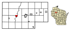
Location of Bruce in Rusk County, Wisconsin.
|
|
| Country | |
| State | |
| County | Rusk |
| Incorporated | 1901 |
| Government | |
| • Type | Village |
| Area | |
| • Total | 2.36 sq mi (6.11 km2) |
| • Land | 2.31 sq mi (5.98 km2) |
| • Water | 0.05 sq mi (0.13 km2) |
| Elevation | 1,106 ft (337 m) |
| Population
(2020)
|
|
| • Total | 781 |
| • Estimate
(2022)
|
775 |
| • Density | 305.46/sq mi (117.94/km2) |
| Time zone | UTC-6 (Central (CST)) |
| • Summer (DST) | UTC-5 (CDT) |
| Area code(s) | 715 & 534 |
| FIPS code | 55-10500 |
| GNIS feature ID | 1562279 |
| Website | http://www.villageofbruce.org/ |
Bruce is a small village located in Rusk County, Wisconsin, in the United States. In 2020, about 781 people lived there. The village was started in 1884 by a company called the Sault Ste. Marie Land and Improvement Company. This company was connected to a railway, the Minneapolis, Sault Ste. Marie and Atlantic Railway. The first train arrived in Bruce in November 1884. The village was named after Alanson C. Bruce, who ran a logging camp in the area.
Contents
Where is Bruce, Wisconsin?
Bruce is located at coordinates 45°27′26″N 91°16′23″W / 45.45722°N 91.27306°W. This means it's in the northern part of the United States.
Bruce's Size and Surroundings
The United States Census Bureau says that Bruce covers a total area of about 2.39 square miles (6.19 square kilometers). Most of this area is land, about 2.34 square miles (6.06 square kilometers). A small part, about 0.05 square miles (0.13 square kilometers), is water.
Getting Around Bruce
You can reach Bruce by driving on two main roads. These are U.S. Highway 8 and Wisconsin Highway 40.
Who Lives in Bruce? Demographics
This section tells us about the people who live in Bruce. It looks at things like how many people there are and their ages.
Bruce's Population Over Time
The table below shows how the number of people living in Bruce has changed over many years.
| Historical population | |||
|---|---|---|---|
| Census | Pop. | %± | |
| 1910 | 565 | — | |
| 1920 | 561 | −0.7% | |
| 1930 | 548 | −2.3% | |
| 1940 | 596 | 8.8% | |
| 1950 | 867 | 45.5% | |
| 1960 | 815 | −6.0% | |
| 1970 | 799 | −2.0% | |
| 1980 | 905 | 13.3% | |
| 1990 | 844 | −6.7% | |
| 2000 | 787 | −6.8% | |
| 2010 | 779 | −1.0% | |
| 2020 | 781 | 0.3% | |
| 2022 (est.) | 775 | −0.5% | |
| U.S. Decennial Census | |||
A Look at Bruce's Community (2010)
According to the census from 2010, there were 779 people living in Bruce. These people lived in 371 different homes. About 203 of these homes were families.
The village had about 333 people per square mile (128 people per square kilometer). There were 419 housing units in total.
Most of the people in Bruce were White, making up 99.1% of the population. About 0.9% of the people were from two or more races. About 1.0% of the population identified as Hispanic or Latino.
Homes and Families in Bruce
Out of the 371 homes, about 26.1% had children under 18 living there. About 38.5% of homes were married couples living together. Some homes had a female head of household without a husband (11.9%). A smaller number had a male head of household without a wife (4.3%).
About 45.3% of all homes were not families. This means they might be individuals living alone. In fact, 41.8% of homes were just one person. About 23.4% of these single-person homes had someone 65 years old or older.
On average, there were 2.10 people in each home. For families, the average size was 2.85 people.
Age Groups in Bruce
The average age of people in Bruce was 45.9 years old.
- About 24.1% of residents were under 18 years old.
- About 6.4% were between 18 and 24 years old.
- About 18.7% were between 25 and 44 years old.
- About 25.5% were between 45 and 64 years old.
- About 25.4% were 65 years old or older.
In terms of gender, 47.2% of the population was male. The other 52.8% of the population was female.
See also
 In Spanish: Bruce (Wisconsin) para niños
 | Isaac Myers |
 | D. Hamilton Jackson |
 | A. Philip Randolph |

