Bruinisse facts for kids
Quick facts for kids
Bruinisse
|
||
|---|---|---|
|
Village
|
||

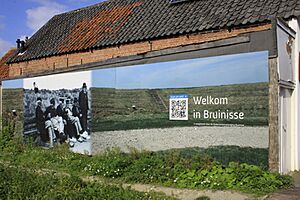
Welkom in Bruinisse (Welcome to Bruinisse)
|
||
|
||
| Country | Netherlands | |
| Province | Zeeland | |
| Municipality | Schouwen-Duiveland | |
| Area | ||
| • Total | 13.23 km2 (5.11 sq mi) | |
| Elevation | 0.8 m (2.6 ft) | |
| Population
(2021)
|
||
| • Total | 3,775 | |
| • Density | 285.34/km2 (739.0/sq mi) | |
| Time zone | UTC+1 (CET) | |
| • Summer (DST) | UTC+2 (CEST) | |
| Postal code |
4311
|
|
| Dialing code | 0111 | |
Bruinisse is a lovely village located in the southwest part of the Netherlands. It is found in the municipality of Schouwen-Duiveland, which is in the province of Zeeland. This village is well-known for its strong connection to the sea and its history of mussel fishing.
Contents
History of Bruinisse
How Bruinisse Began
Bruinisse was first mentioned around 1480 or 1481. Its name comes from words meaning "headland" and "mud." Originally, Bruinisse was an island. In 1452, a ruler named Philip the Good gave permission to build dikes. These dikes helped create polders, which are pieces of land reclaimed from the sea. The polder was finished in 1468.
Village Life and Growth
Bruinisse was built as a "front street village." This means houses were mostly along one main street. A half-circle road went around the church. For a long time, the village's main way of making money was mussel fishing. To support this, the harbour was made bigger in 1872 and again in 1912.
The local Reformed Church was built in 1904. It has a neoclassic style. This church replaced an older one from 1868. In 1962, the church was fixed up, and its entrance was moved to the side. By 1840, about 1,430 people lived in Bruinisse.
Challenges and Changes
Bruinisse faced tough times during World War II. On February 12, 1944, German forces flooded the land around the village. Later, on January 5, 1945, the Allies bombed the area. This bombing destroyed many homes, including the old church from 1467.
The village also suffered from the North Sea flood of 1953. This was a very big flood that caused a lot of damage. After these events, new projects helped protect the area. In 1964, the Grevelingendam was built. This dam connected Schouwen-Duiveland with another island called Goeree-Overflakkee. A new area for fun and boats, with a marina, was also built northwest of the village.
Bruinisse used to be its own separate municipality (a type of local government). But in 1997, it joined with other villages to become part of the larger municipality of Schouwen-Duiveland.
Gallery
See also
 In Spanish: Bruinisse para niños
 | Misty Copeland |
 | Raven Wilkinson |
 | Debra Austin |
 | Aesha Ash |


