Brushwood, New South Wales facts for kids
Quick facts for kids BrushwoodNew South Wales |
|
|---|---|

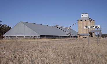
Silos at Brushwood
|
|
| Location |
|
| LGA(s) | Coolamon Shire |
| County | Bourke |
| State electorate(s) | Cootamundra |
| Federal Division(s) | Division of Riverina |
Brushwood is a small rural community located in the central east part of the Riverina region of New South Wales, Australia. It's a quiet place known for its farming. You can find Brushwood about 6 kilometres (about 3.7 miles) east of Ganmain and 8 kilometres (about 5 miles) west of Coolamon.
What is Brushwood Like?
Brushwood is an important part of the wheat farming belt in the Coolamon Shire Council area. This means that growing wheat and other grains is a big part of life here. The community helps to produce food for many people!
The Railway and Silos
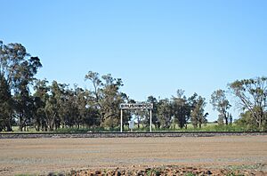
Brushwood has a small railway station. This station is not for passengers, but it's very important for farmers. It's used to load wheat and other grains onto trains. These trains then carry the grains to other places.
Next to the railway station, you'll see some very tall structures called silos. These silos are like giant storage containers. They are about 30 metres (about 98 feet) high! Farmers use them to store huge amounts of wheat and other grains after they are harvested. This keeps the grains safe until they can be transported.
Where is Brushwood Located?
Brushwood is in the Riverina region of New South Wales. The Riverina is a large area known for its flat plains and farming. It's a very productive agricultural region in Australia.
- It is about 474 kilometres (295 miles) southwest of Sydney, the capital city of New South Wales.
- It is also about 52 kilometres (32 miles) northwest of Wagga Wagga, a larger regional city.
- The nearby towns of Ganmain and Coolamon are just a short drive away.
 | Delilah Pierce |
 | Gordon Parks |
 | Augusta Savage |
 | Charles Ethan Porter |


