Buarth-y-Gaer facts for kids

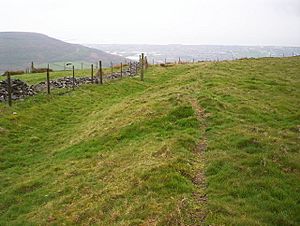
Ramparts of Buarth-y-Gaer, along southeast side.
|
|
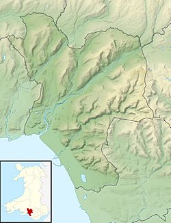
| Location | summit of Mynydd-y-Gaer, Neath Port Talbot, Wales (OS Grid ref SS765939) |
|---|---|
| Region | South Wales |
| Coordinates | 51°37′39″N 3°47′06″W / 51.6276°N 3.7849°W |
| Type | Hillfort |
| Area | 1.1 ha (2.7 acres) |
| History | |
| Periods | Iron Age |
| Cultures | Celtic Brittonic |
| Site notes | |
| Condition | A single bank and ditch, damaged by quarrying on south side. |
| Public access | No |
| Reference no. | GM054 |
Buarth-y-Gaer is an ancient site from the Iron Age in Wales. It is located on top of a hill called Mynydd-y-Gaer, about 300 meters (980 feet) above sea level. This site is in the Briton Ferry area, near Neath, in Neath Port Talbot, South Wales.
It is often called a "hillfort," but it might be more like a large enclosed area. It has a single bank and ditch that go around it. Inside this enclosed space, there is also a much older burial mound from the Bronze Age.
Where is Buarth-y-Gaer?
This ancient site sits on the highest point of Mynydd-y-Gaer mountain. It's one of three similar sites found on this long, high ridge. Another smaller site, Craig Ty-Isaf, is to the south-west. Gaer Fawr is about 800 meters (870 yards) to the north.
Mynydd-y-Gaer has a rounded top with grassy fields and stone walls. The hill overlooks the Neath estuary and the town of Briton Ferry. The village of Baglan is at the bottom of the hill, about 1 kilometer (0.6 miles) to the south-west.
What Does It Look Like?
Buarth-y-Gaer is shaped roughly like a circle. It measures about 130 meters (140 yards) across. The site covers an area of about 1.1 hectares (2.7 acres) of rough grassland.
The main features are a single bank and a ditch. The bank is about half a meter (1.6 feet) higher than the inside area. From the top of the bank, there is a 2-meter (6.6 feet) drop down to the bottom of the ditch. Some parts of the bank on the south side have been damaged by old quarrying. There are also some modern gaps in the bank. The original entrance to the site is on the west side.
This site is protected as a "scheduled monument." This means it's an important historical place that is looked after. Even though the mountain name "Mynydd-y-Gaer" means "Mountain of the Fort," and it's called a "hillfort," it doesn't seem to have been built for strong defense. It might have been more of a protected enclosure.
The Bronze Age Burial Mound
Inside the main enclosed area, there is a Bronze Age burial mound. This mound is even older than the Iron Age enclosure itself. It is about 0.8 meters (2.6 feet) high and 11.6 meters (38 feet) across. It is the only feature found inside the main enclosure.
 | Frances Mary Albrier |
 | Whitney Young |
 | Muhammad Ali |


