Buenavista del Norte facts for kids
Quick facts for kids
Buenavista del Norte
|
|||
|---|---|---|---|
|
Municipality and town
|
|||
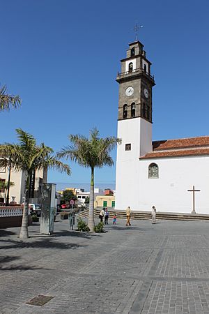
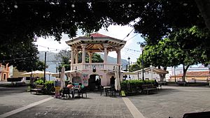
Main square: Nuestra Señora de Los Remedios
|
|||
|
|||
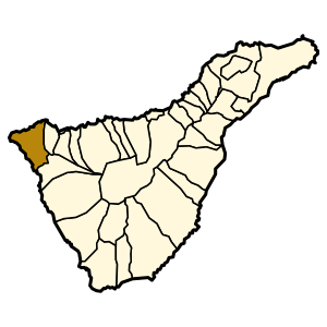
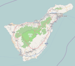
Municipal location in Tenerife
|
|||
| Country | |||
| Autonomous Region | Canary Islands | ||
| Province | Santa Cruz de Tenerife | ||
| Island | Tenerife | ||
| Area | |||
| • Total | 67.42 km2 (26.03 sq mi) | ||
| Population
(2018)
|
|||
| • Total | 4,755 | ||
| • Density | 70.528/km2 (182.67/sq mi) | ||
| Time zone | UTC+0 (GMT) | ||
| Post Code |
38480
|
||
| Website | www.buenavistadelnorte.com | ||
Buenavista del Norte is a town and a "municipality" (like a county or district) on the northwest coast of Tenerife. Tenerife is one of the Canary Islands in Spain. The town is about 75 kilometers (47 miles) west of the capital city, Santa Cruz de Tenerife. It is also close to both of Tenerife's airports.
The buildings in Buenavista del Norte show a simple, traditional style. This style comes from the Andalusia region of Spain. The area also has a mix of traditions from Portuguese settlers and the original people of the Canary Islands, called the Guanches. This mix gives the district its special charm. People here have always been good at keeping old traditions alive. They do this through crafts made from bone, wood, cane, and straw. These materials come from the local forests.
Contents
The municipality of Buenavista del Norte is at the very northwest tip of Tenerife. It shares borders with Los Silos to the east and Santiago del Teide to the south. You can reach Los Silos by road TF42. The road to Santiago del Teide (TF436) goes through the amazing, winding Masca area. This part of the road is about 650 meters (2,130 feet) above sea level.
The total area of the municipality is 67.42 square kilometers (26 square miles). This is only about 3% of the whole island's size. A large part of the land is made up of the Macizo de Teno mountains. These mountains were formed by volcanoes over 7 million years ago.
Most of the people in Buenavista del Norte live in the main town. This area is known as Casco Antiguo, which means "old town." About 75% of the population lives here. The rest of the people live in smaller villages.
About 9% of the residents live in El Palmar. This village is 300 to 500 meters (980 to 1,640 feet) above sea level. Further along the same road is Las Portelas, where 6% of the people live. This village is even higher, at 650 meters (2,130 feet). Las Canteras has another 5.5% of the population. Other places like Masca, Teo, and Los Carrizales have very few people.
The villages of Masca, Teno Alto, Los Carrizales, El Palmar, Las Portelas, and Las Lagunetas still follow old farming traditions of the Canary Islands. Closer to the coast, growing bananas is the main type of farming.
Coastal Plants and Their Adaptations
The coastal area of Buenavista del Norte has a special climate. It is called "inframediterranean." Here, you can find both native plants and plants that were brought from other places. These plants often help each other. For example, some plants might protect native ones from strong winds or erosion.
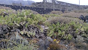
You will see many prickly pear cacti and balsam spurge plants. These are very common along the coast, even as close as 30 meters (100 feet) from the ocean. Another large plant is the Canary Island spurge. You can also find plants like Patellifolia and Kleinia neriifolia. These plants are often found near the rocky cliffs. They can handle salty conditions and dry periods well.
Many plants here have special ways to survive. Some lose their leaves during dry times and grow new ones after the first autumn rains. Others, like Schizogyne sericea, form large bushes with yellow flowers. Sea fennel is another plant found on the cliffs. It has a distinct smell and grey-green leaves. These plants show how nature adapts to the unique coastal environment.
Buenavista del Norte has a Mediterranean climate. This means most of its rain falls between October and March. Because it is on the northwest coast, it catches a lot of the moisture from the mountains. This means it gets more than three times the rainfall compared to Santa Cruz de Tenerife.
| Climate data for Buenavista del Norte | |||||||||||||
|---|---|---|---|---|---|---|---|---|---|---|---|---|---|
| Month | Jan | Feb | Mar | Apr | May | Jun | Jul | Aug | Sep | Oct | Nov | Dec | Year |
| Mean daily maximum °C (°F) | 17.1 (62.8) |
17.0 (62.6) |
17.2 (63.0) |
17.3 (63.1) |
18.6 (65.5) |
19.9 (67.8) |
22.3 (72.1) |
23.1 (73.6) |
22.6 (72.7) |
21.5 (70.7) |
19.0 (66.2) |
17.3 (63.1) |
19.4 (66.9) |
| Mean daily minimum °C (°F) | 12.1 (53.8) |
11.5 (52.7) |
11.8 (53.2) |
11.9 (53.4) |
13.1 (55.6) |
14.4 (57.9) |
16.7 (62.1) |
17.7 (63.9) |
17.2 (63.0) |
16.5 (61.7) |
14.9 (58.8) |
13.0 (55.4) |
14.2 (57.6) |
| Average precipitation mm (inches) | 167 (6.6) |
95 (3.7) |
70 (2.8) |
18 (0.7) |
12 (0.5) |
9 (0.4) |
1 (0.0) |
3 (0.1) |
4 (0.2) |
90 (3.5) |
207 (8.1) |
122 (4.8) |
798 (31.4) |
| Source: Sistema de Clasificación Bioclimática Mundial | |||||||||||||
 |
Atlantic Ocean |  |
||
| Atlantic Ocean | Los Silos | |||
| Santiago del Teide |
See also
 In Spanish: Buenavista del Norte para niños
 | Misty Copeland |
 | Raven Wilkinson |
 | Debra Austin |
 | Aesha Ash |


