Burdell Island facts for kids

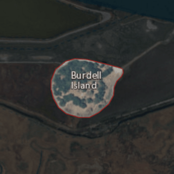
USGS aerial imagery of Burdell Island
|
|
| Geography | |
|---|---|
| Location | Northern California |
| Coordinates | 38°09′22″N 122°33′17″W / 38.15611°N 122.55472°W |
| Adjacent bodies of water | Petaluma River |
| Highest elevation | 52 ft (15.8 m) |
| Administration | |
|
United States
|
|
| State | |
| County | Marin |
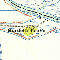
Burdell Island is a special place in Marin County, California. It used to be a real island, completely surrounded by water and swampy land. Today, most of the land around it is dry. However, Burdell Island itself is still much higher than the areas nearby.
What is Burdell Island?
Burdell Island is located near the Petaluma River. This river flows into San Pablo Bay, which is a part of the bigger San Francisco Bay. Even though it's called an "island," it's mostly surrounded by dry land now. It's a great example of how land can change over time!
Where is Burdell Island Located?
You can find Burdell Island in Northern California. Its exact spot is at these coordinates: 38°09′22″N 122°33′17″W / 38.15611°N 122.55472°W. It's part of Marin County, a county in California.
How High is Burdell Island?
In 1981, the United States Geological Survey (which is a group that studies the Earth) measured Burdell Island. They found that its highest point is about 52 feet (or about 16 meters) above sea level. This is why it still stands out from the land around it, even though the water has receded.


